
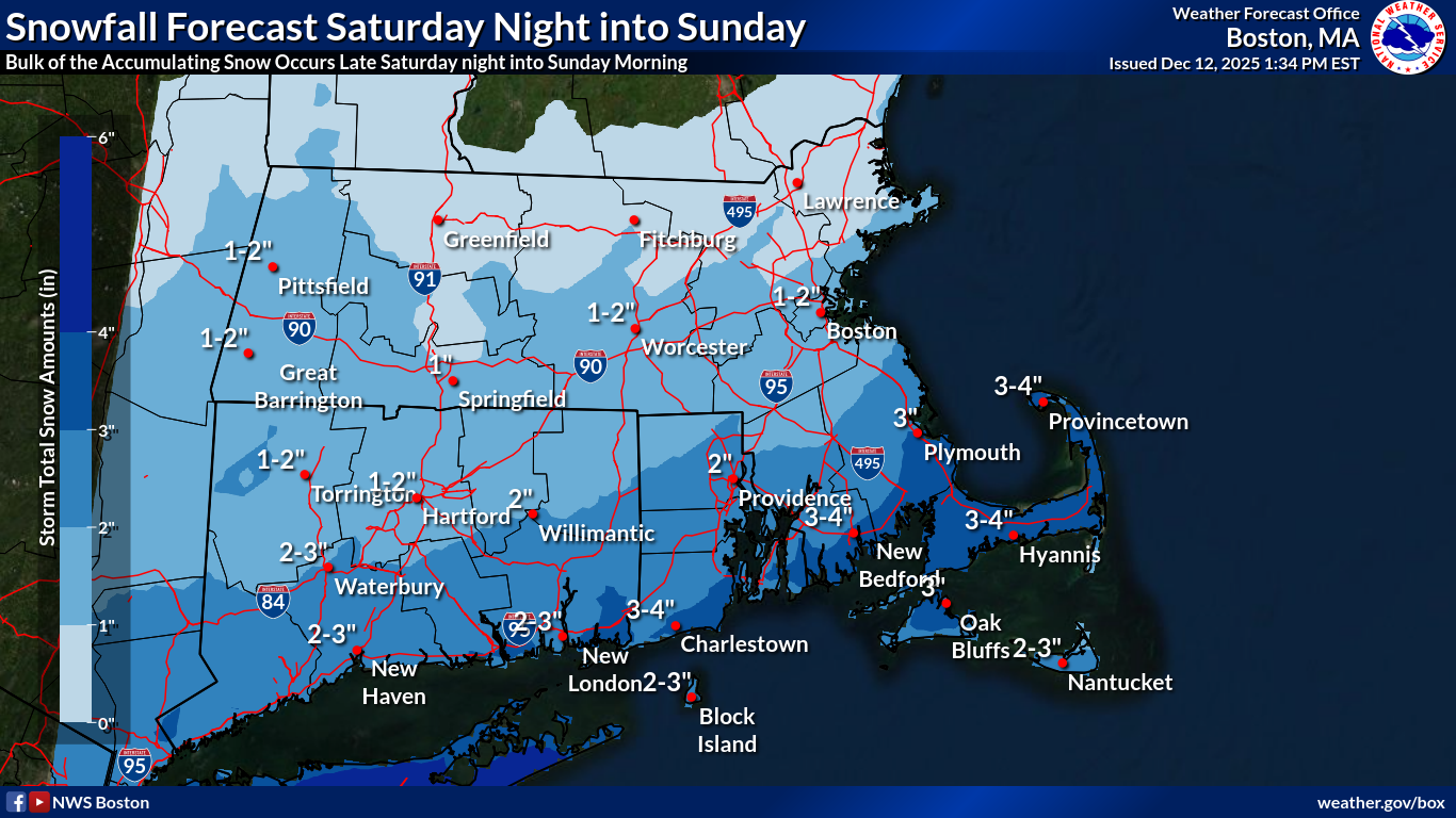
Good afternoon, There have been no changes to the forecast and briefing since early this morning. An updated one-pager briefing is attached. Preliminary snowfall forecast still indicates the potential for 1-2" south of I-90 with perhaps a localized swath of 3-4" near the south coast, while only a dusting to 1" of snow is expected north of I-90. There remains some uncertainty on the northern extent of the snow shield. A further north trend would bring the potential for 1-2" into northern MA and 3-5" south of I-90. A shift further to the south would result in little if any snow north of I-90 and only a coating to 1" south of I-90. Please let us know if you have any questions or concerns. Thanks. Meteorologist: Kevin Cadima If you have any questions or would like more information, please don't hesitate to contact us. You can reach us via: email: box.operations@noaa.gov phone: 508.622.3280 Slack/NWSChat 2.0 <https://nwschatws.slack.com/> (for approved partners) social media: Website <http://www.weather.gov/boston> | Facebook <http://www.facebook.com/NWSBoston> | Twitter <http://www.twitter.com/NWSBoston>