
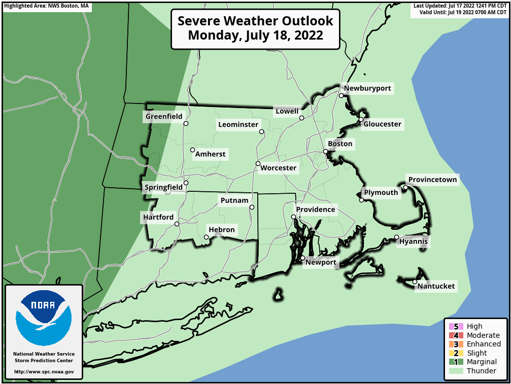
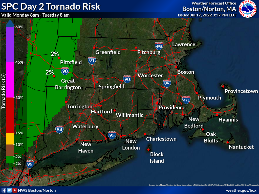
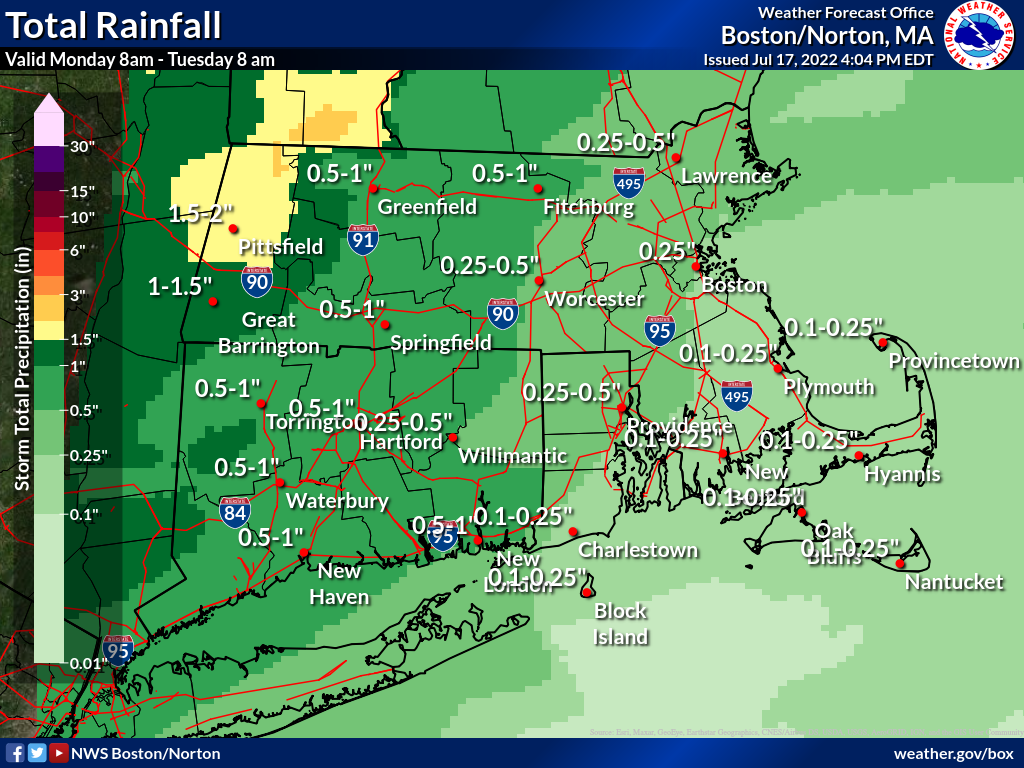
Good afternoon, Attached is a one page briefing regarding the potential for severe thunderstorms and heavy rainfall/localized flash flooding Monday afternoon. The greatest threat is across western MA/CT. Damaging wind gusts are the primary threat but there also exists a risk for an isolated tornado. In addition to the damaging winds/isolated tornado threat, there is also a marginal risk for localized flash flooding. Additional information can be found in the one pager and supporting graphics. Thank you, -Rob Megnia, Kevin Cadima, Torry Gaucher If you have any questions or would like more information, don't hesitate to contact us via this email address, on NWSChat <https://nwschat.weather.gov/>, or at the following: National Weather Service Boston/Norton, MA 46 Commerce Way Norton, MA 02766 508.622.3280 Website <http://www.weather.gov/boston> | Facebook <http://www.facebook.com/NWSBoston> | Twitter <http://www.twitter.com/NWSBoston>