
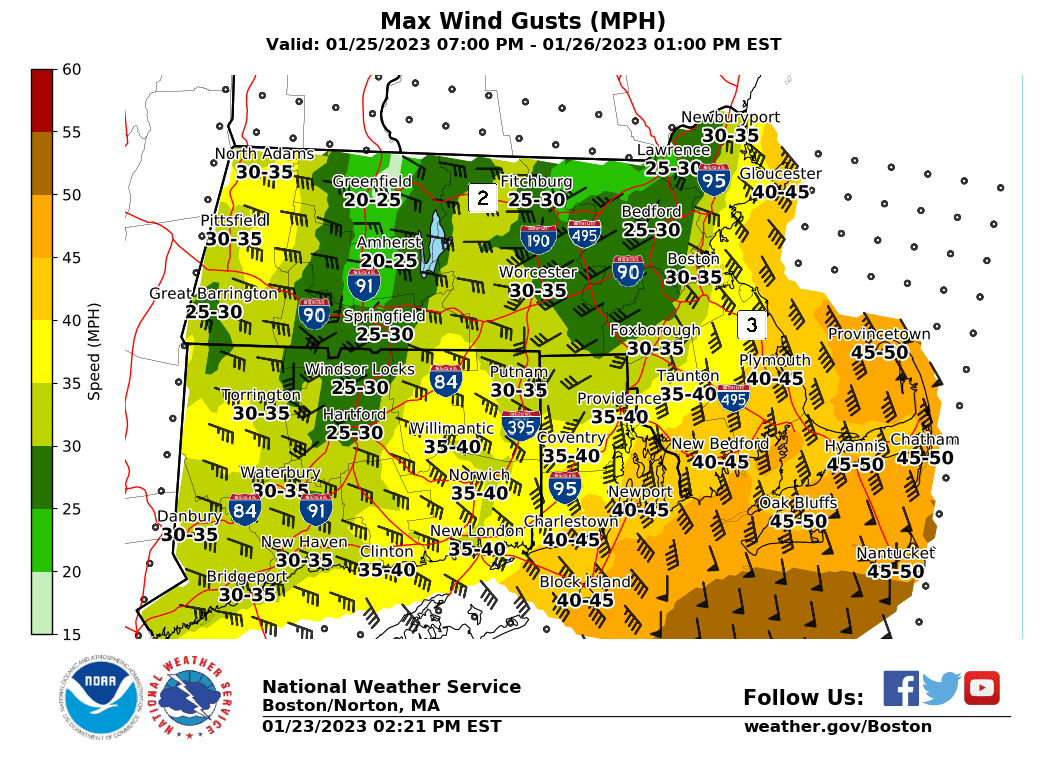
Good afternoon, No changes for the current storm. The heaviest snow will be focused across RI and eastern MA through early evening before tapering off 7-9 pm. Brief snowfall rates up to 1"/hr are possible which will impact the evening commute. Another storm will impact the region Wed afternoon and night. We expect snow developing from SW to NE Wed afternoon, but changing to rain Wed evening and overnight from S to N. The rain-snow line will likely move north of MA around or a few hours after midnight Wed night. In addition, a period of strong to potentially damaging winds gusts are possible across SE New Eng late Wed night and early Thu. There is also a low risk for minor coastal flooding along the south and east coasts for late Wed night high tide but this will depend on the max storm surge coinciding with high tide. There is still some uncertainty with the exact timing. Thanks. Kevin Cadima and Kristie Smith If you have any questions or would like more information, don't hesitate to contact us via this email address, on NWSChat <https://nwschat.weather.gov/>, or at the following: National Weather Service Boston/Norton, MA 46 Commerce Way Norton, MA 02766 508.622.3280 Website <http://www.weather.gov/boston> | Facebook <http://www.facebook.com/NWSBoston> | Twitter <http://www.twitter.com/NWSBoston>