
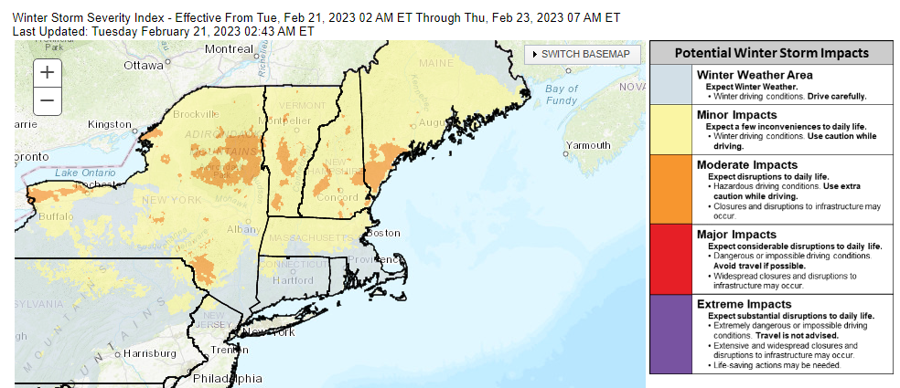
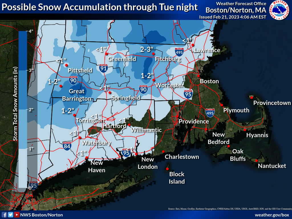
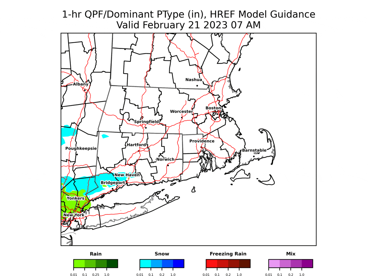
Good morning, Two minor/nuisance precipitation events are expected this morning and again this evening/overnight, with a mix of snow and rain. Given temperatures will be above freezing, roads will remain mainly wet, with little to no impact. However, across the high terrain of Massachusetts, including the Worcester Hills, temperatures around freezing may yield snow accumulations of 1-3 inches, mainly on non paved surfaces, except across the highest elevations, especially on secondary roads and untreated surfaces. 1-3 inches is the total accumulation for both events, this morning and again this evening and overnight. Attached is a model simulated radar loop, not expected to be exact, but to give you a feel for the overall precipitation type, timing and evolution of precipitation this morning through tonight. Also, attached is a map with potential snowfall for this morning through tonight. A more significant winter weather event is possible Wednesday night through Thursday night, when a mix of snow, sleet and freezing rain is expected to impact the region, with the greatest impact likely across northern Massachusetts. Slipper travel may impact the Thursday morning commute. The attached map (potential weather impacts) indicates the area with the greatest impact likely across northern MA. Frank Nocera & Torry Gaucher If you have any questions or would like more information, don't hesitate to contact us via this email address, on NWSChat <https://nwschat.weather.gov/>, or at the following: National Weather Service Boston/Norton, MA 46 Commerce Way Norton, MA 02766 508.622.3280 Website <http://www.weather.gov/boston> | Facebook <http://www.facebook.com/NWSBoston> | Twitter <http://www.twitter.com/NWSBoston>