
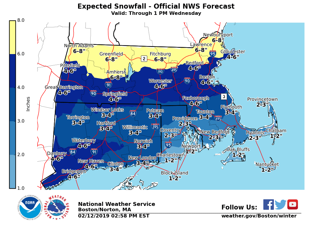
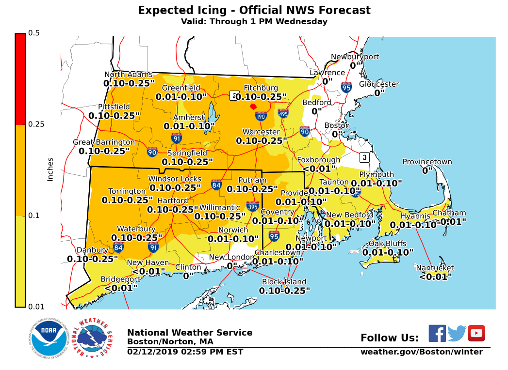
Good afternoon: *What has changed ...* *No changes to hazards with the afternoon update. * - *WINTER STORM WARNINGS ...* - Continue for northern and northeast Massachusetts; Berkshire County, Massachusetts and Litchfield County, Connecticut. - *WINTER WEATHER ADVISORIES ... * - Continue for areas along and south of the Massachusetts Turnpike, including all of Connecticut except for Litchfield County, and all of Rhode Island except for Block Island. - Please see the attached graphic outlining headlines. *What / Where / When ...* - *Significant impact for today's afternoon into evening commute* - Transition to wintry mix has already begun across CT this afternoon - Sleet will approach the Massachusetts Turnpike between 4-5 PM, and the MA/NH/VT border between 6-7 PM - Latest snow/sleet total accumulations are attached - Ice accretion of a trace up to two tenths across interior Southern New England, especially around the Worcester / Hartford / Springfield region. - A low threat of tree and power line damage. - Please see the attached storm total ice accretion graphic for specifics. - Please see the attached animated graphic highlighting precipitation-types for rough estimate of timing. - Hazardous travel conditions with slick roadways. - Expect a longer commute - Reductions in visibility with any snow and / or sleet. - Lower visibility, especially as around 1 inch per hour snowfall rates are possible, before mixing with then changing over to sleet - Moderate to heavy snow, mostly falling during today's afternoon into evening commute across MA - Less impact to the Wednesday AM commute as steadier precipitation ends, some show shower activity lingering across northwest MA - However can't rule out some lingering icy roadways across interior MA and CT, especially if left untreated. *Uncertainty ... * - While specific snow amounts are still uncertain, hinging on exactly when snow will change to sleet, the bigger message is the anticipated *significant impact* to this evening commute. Please, do not hesitate. Should you have any questions, comments and/or concerns, we are here 24 / 7 to help you. If you are looking for an hour-by-hour forecast for your area, please visit the following website below ... https://forecast.weather.gov/gridpoint.php?site=box&TypeDefault=graphical Matthew Belk If you have any questions or would like more information, don't hesitate to contact us via this email address, on NWSChat <https://nwschat.weather.gov/>, or at the following: National Weather Service Boston/Norton, MA 46 Commerce Way Norton, MA 02766 508.622.3280 Website <http://www.weather.gov/boston> | Facebook <http://www.facebook.com/NWSBoston> | Twitter <http://www.twitter.com/NWSBoston>