
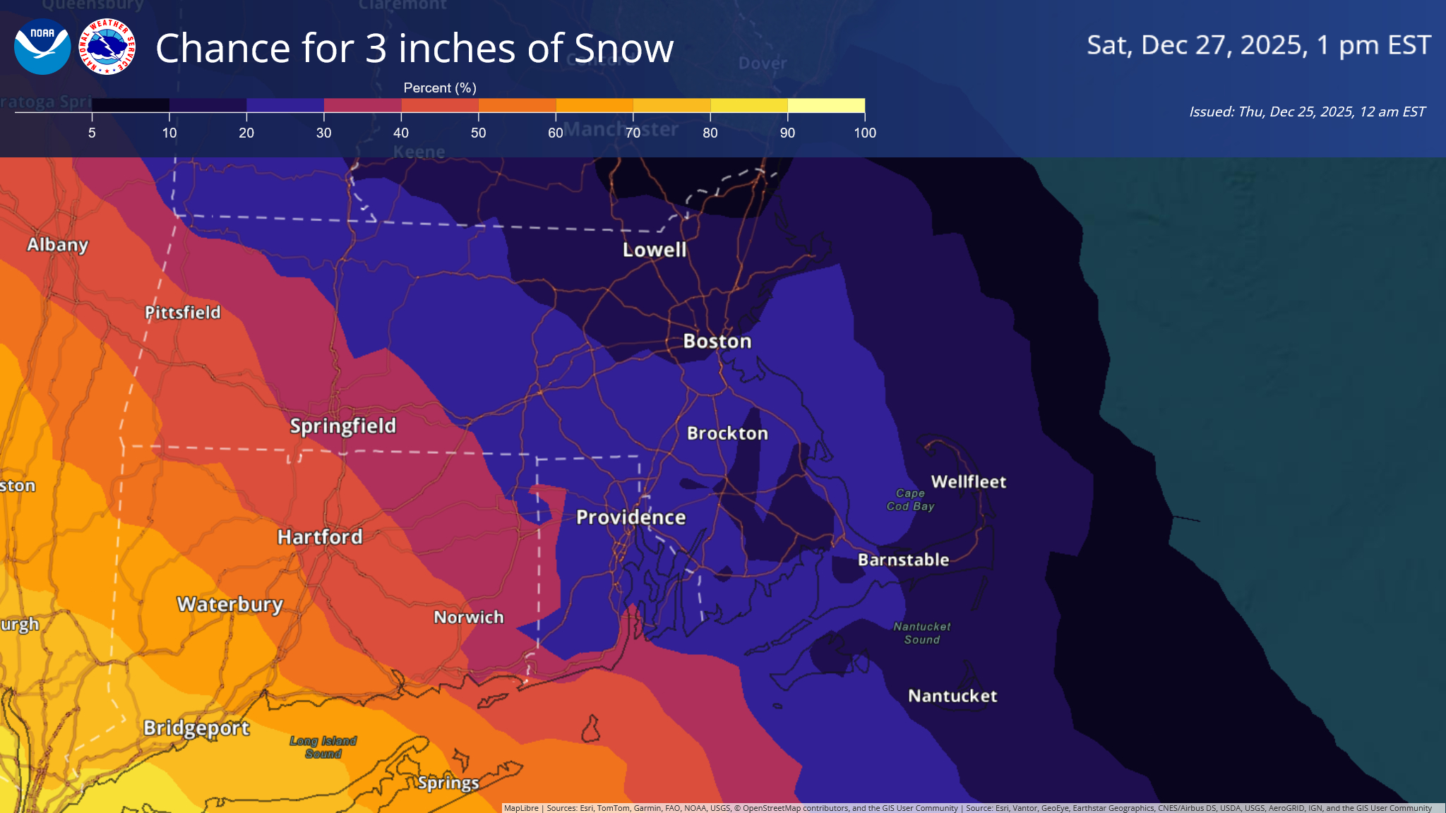
Good Morning and Merry Christmas, We are tracking a storm system that could bring plowable snow to the region starting Friday night into Saturday morning. Uncertainty at this time remains high, but the best chance for 3+ inches of snow are in southwest Connecticut, including the Hartford metro area. Attached are the chances of 3 and 6 inches of snow across Southern New England ending 1 pm Saturday. Over the coming days, we will be watching this system's track very closely, as any movement to the north could bring significant accumulations to the region. Please let us know if you have any questions or concerns! Meteorologist: Kyle Pederson If you have any questions or would like more information, please don't hesitate to contact us. You can reach us via: email: box.operations@noaa.gov phone: 508.622.3280 Slack/NWSChat 2.0 <https://nwschatws.slack.com/> (for approved partners) social media: Website <http://www.weather.gov/boston> | Facebook <http://www.facebook.com/NWSBoston> | Twitter <http://www.twitter.com/NWSBoston>