
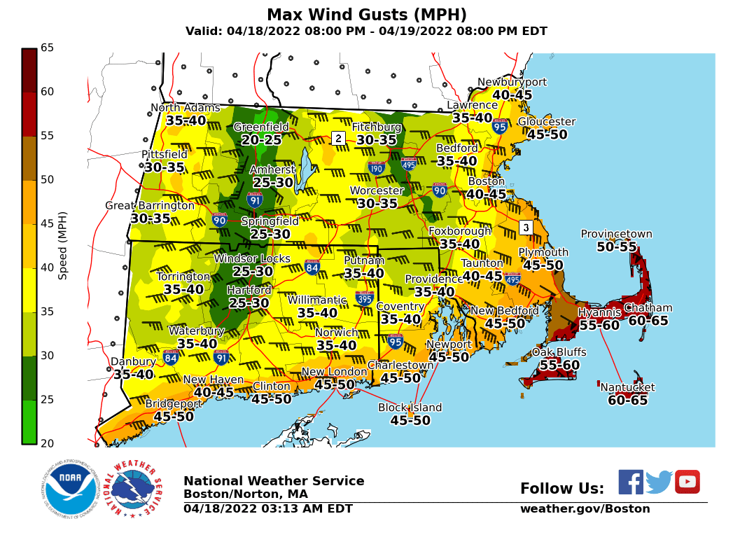
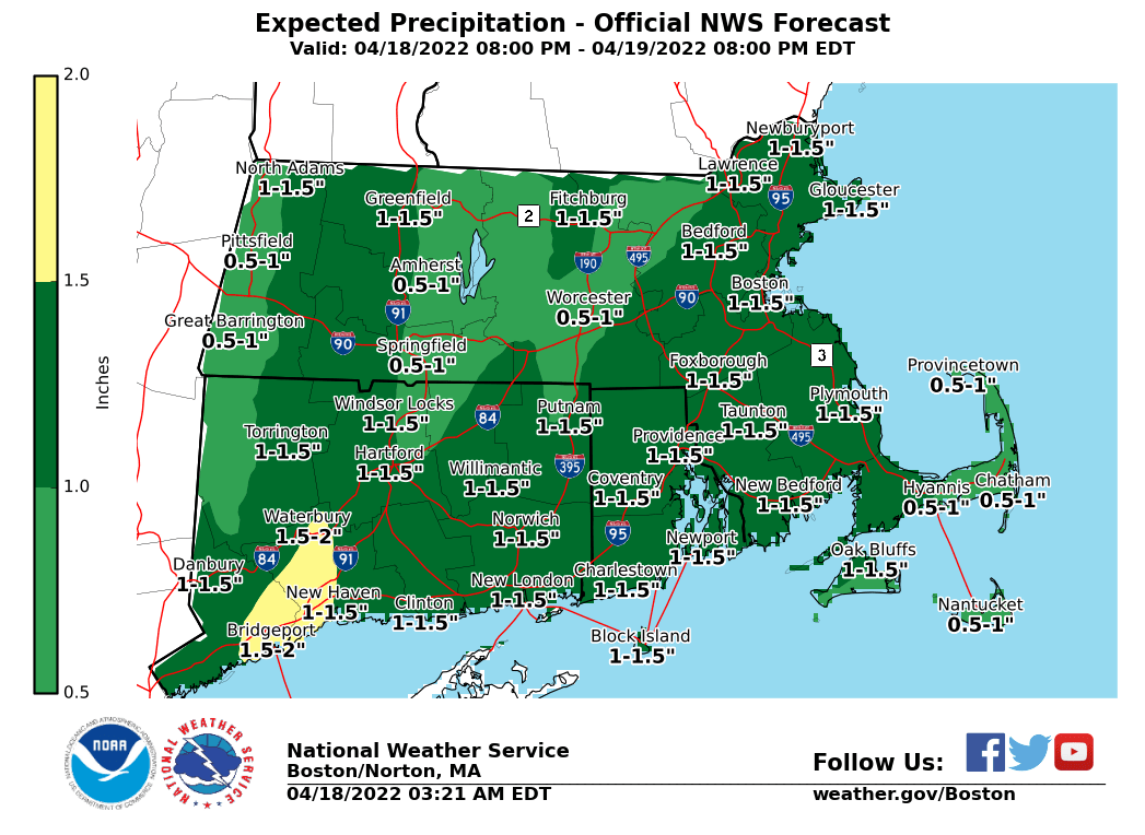
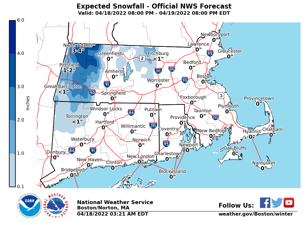
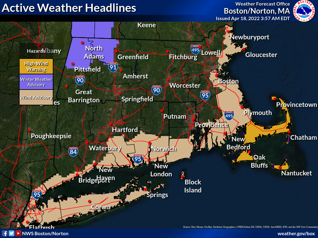
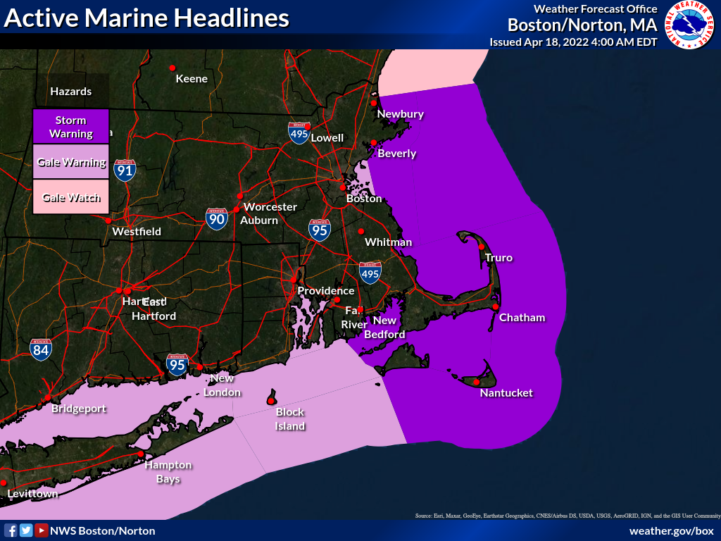
Good morning, Attached is an updated 1 page briefing and supporting graphics regarding a storm expected to produce multiple weather hazards tonight into tomorrow morning. *What Has Changed?* - Winter weather advisory for western Franklin county. This will be for up to 4 inches of heavy wet snowfall *at elevations above 1500 feet. * - High wind watch upgraded to high wind warning for Barnstable, Dukes, and Nantucket counties. - Wind advisory in effect for Essex, Suffolk, Norfolk, Plymouth, Bristol counties in MA and Block Island, Washington, and Newport counties in RI. There also remains a threat for splashover/minor coastal flooding overnight. No coastal flood headlines are active at this time, but we will revisit the need for any potential coastal flood headlines this afternoon. Thank you, Rob Megnia and Rodney Chai If you have any questions or would like more information, don't hesitate to contact us via this email address, on NWSChat <https://nwschat.weather.gov/>, or at the following: National Weather Service Boston/Norton, MA 46 Commerce Way Norton, MA 02766 508.622.3280 Website <http://www.weather.gov/boston> | Facebook <http://www.facebook.com/NWSBoston> | Twitter <http://www.twitter.com/NWSBoston>