
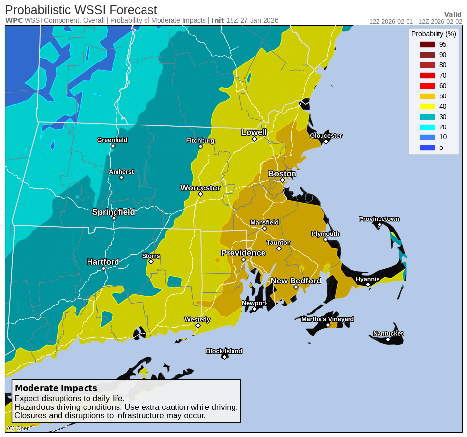
Good afternoon, Attached is a one page briefing on the potential winter storm for Sunday. Given this is a day 5 forecast there are still many unknowns, but it has the potential to be a high impact storm if it tracks close enough to New England. It could also pass far enough offshore to spare southern New England from significant impacts. We included the probability of moderate impacts from the Probabilistic Winter Storm Severity Index (WSSI). We also wanted to highlight the very cold conditions for the rest of the week. We are expecting below zero wind chills during the late night and early morning hours through the rest of the week. In fact, a reinforcing shot of arctic air will likely bring dangerously cold wind chills Thursday night into Friday night which may require cold weather headlines. Thanks. Kevin Cadima and Caitlyn Mensch If you have any questions or would like more information, please don't hesitate to contact us. You can reach us via: email: box.operations@noaa.gov phone: 508.622.3280 Slack/NWSChat 2.0 <https://nwschatws.slack.com/> (for approved partners) social media: Website <http://www.weather.gov/boston> | Facebook <http://www.facebook.com/NWSBoston> | Twitter <http://www.twitter.com/NWSBoston>