
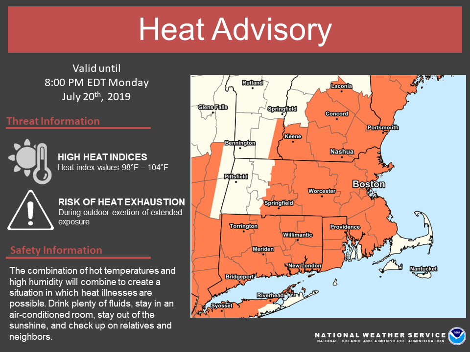
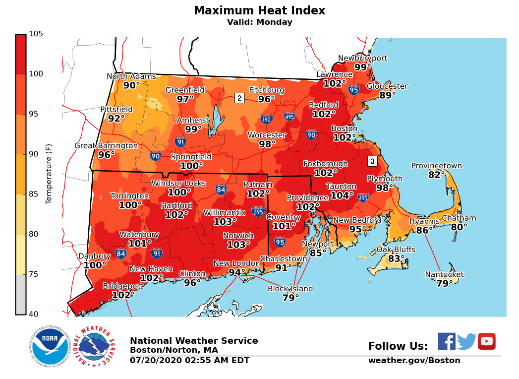
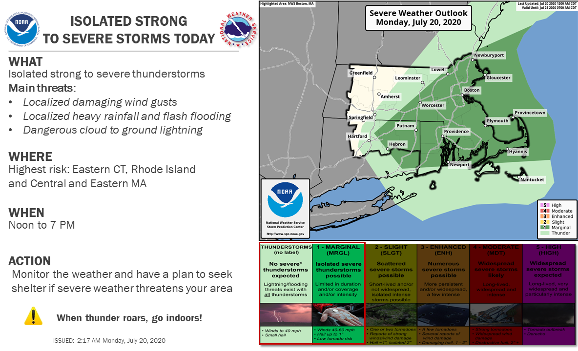
Good morning all, Here is the latest briefing regarding the heat advisory and potential for a few strong to severe storms on Monday. *What Has Changed* The heat advisory was expanded to the south coast of Rhode Island and Massachusetts, except for the Cape/Islands and Newport County RI. *Heat Advisory:* *What:* - Heat index of 98 to 104 degrees. *Where:* - Much of Massachusetts, Connecticut and Rhode Island, except the Cape and Islands and Newport County RI. *When:* - Today *Impacts:* - Heat illnesses may occur with prolonged strenuous activity outdoors. *Thunderstorm Risk:* - A few strong thunderstorms possible this afternoon - Localized damaging wind gusts and heavy rainfall with the stronger storms - Heavy rainfall may produce localized flooding *Confidence: *Areal coverage of storms this afternoon will likely be limited and any showers or thunderstorms moving through this morning may impact instability and potential for stronger storms to develop this afternoon. Attached are the updated Heat Advisory map and maximum heat index values forecast for today. The Severe Thunderstorm Outlook for Monday is also attached. Thank you. Kevin Cadima If you have any questions or would like more information, don't hesitate to contact us via this email address, on NWSChat <https://nwschat.weather.gov/>, or at the following: National Weather Service Boston/Norton, MA 46 Commerce Way Norton, MA 02766 508.622.3280 Website <http://www.weather.gov/boston> | Facebook <http://www.facebook.com/NWSBoston> | Twitter <http://www.twitter.com/NWSBoston>