
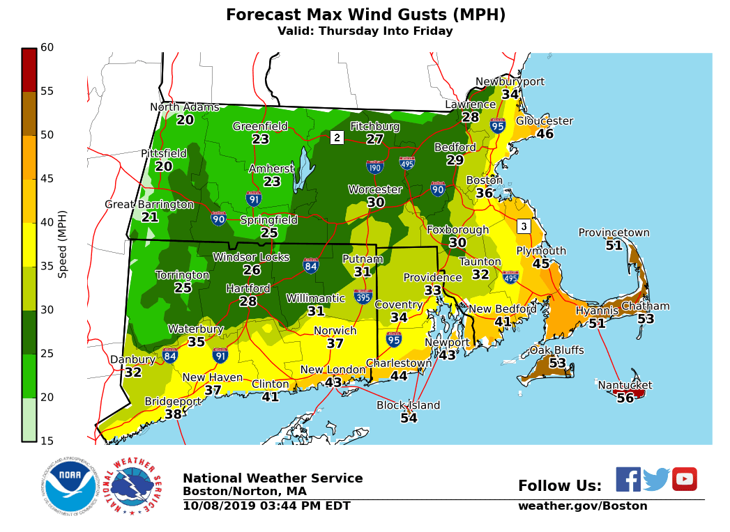
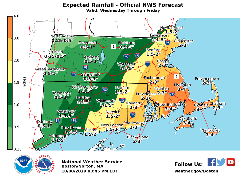
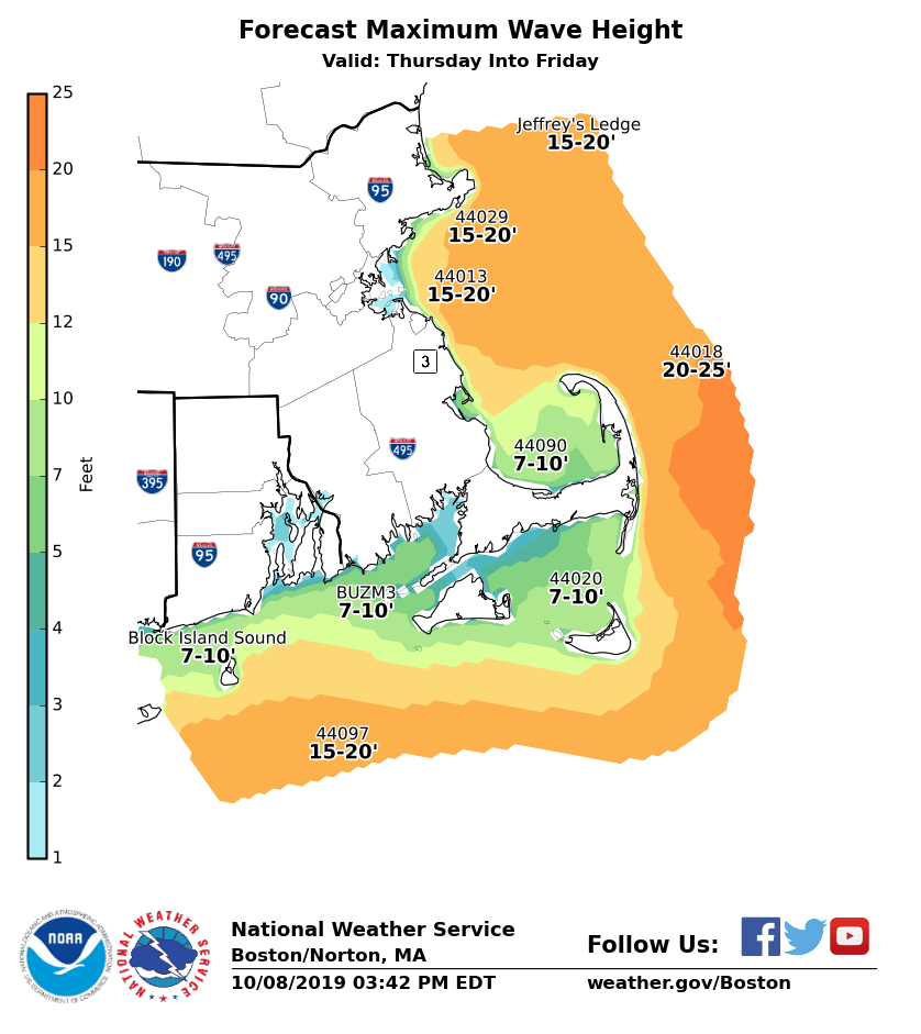
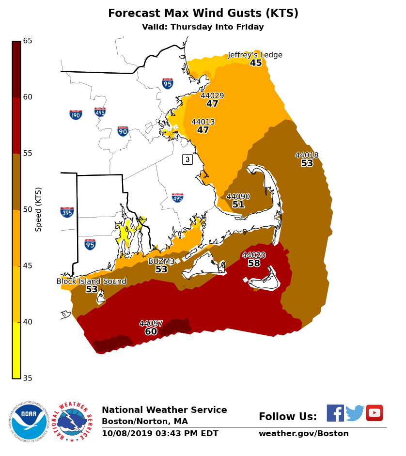
Greetings all, We continue to forecast a late week offshore ocean storm. Confidence is growing for at least some impact to southern New England. Higher end watches have been posted for the Cape and islands, as well as the adjacent coastal waters. These watches highlight the period of greatest concern for the wind threat. Gusty winds will begin *earlier *than when these watches begin. *What ...* - Lashing easterly winds and rain - Potential sustained winds 20 to 30 mph, gusts 30 to 50 mph, perhaps stronger - Possibly heavy rainfall amounts which could lead to localized flooding - Building waves and beach erosion - Gales, potentially storms over the waters with seas building upwards of 20 feet *Where ...* - All of Southern New England under threat - However, the more significant impacts are forecast along the coast, especially the southern RI, southern and southeastern MA coastline, including Cape Cod and the Islands *When ...* - Developing Wednesday, the height of impacts are anticipated late Thursday into Friday - Will see an improving trend beginning as early as Friday night going through the weekend It's important to note that tides are astronomically low. A Coastal Flood Watch has been posted for portions of the South Shore, Cape and islands. There is a risk in these areas for large surges and waves to overcome the lower astronomical tide and possibly result in coastal flooding. These details will evolve with later forecasts. Matthew Belk If you have any questions or would like more information, don't hesitate to contact us via this email address, on NWSChat <https://nwschat.weather.gov/>, or at the following: National Weather Service Boston/Norton, MA 46 Commerce Way Norton, MA 02766 508.622.3280 Website <http://www.weather.gov/boston> | Facebook <http://www.facebook.com/NWSBoston> | Twitter <http://www.twitter.com/NWSBoston>