
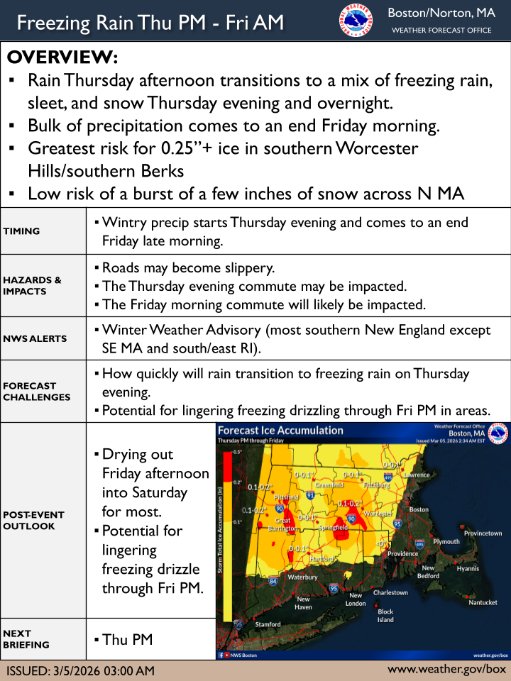
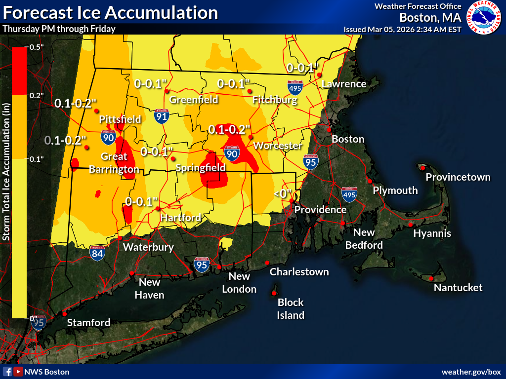
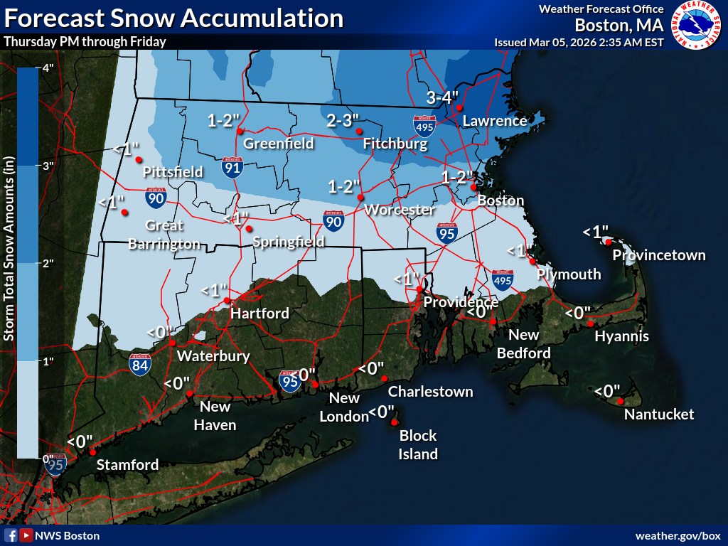
Good morning everyone, There have not been significant changes to the forecast for Thursday night into Friday. The greatest risk for 0.25”+ ice from freezing rain is in the southern Worcester Hills and southern Berkshires, with sleet more likely further north. There is also a low risk for a burst of a few inches of snow across N MA on Friday. Thank you, Bryce Williams and Hayden Frank If you have any questions or would like more information, please don't hesitate to contact us. You can reach us via: email: box.operations@noaa.gov phone: 508.622.3280 Slack/NWSChat 2.0 <https://nwschatws.slack.com/> (for approved partners) social media: Website <http://www.weather.gov/boston> | Facebook <http://www.facebook.com/NWSBoston> | Twitter <http://www.twitter.com/NWSBoston>