
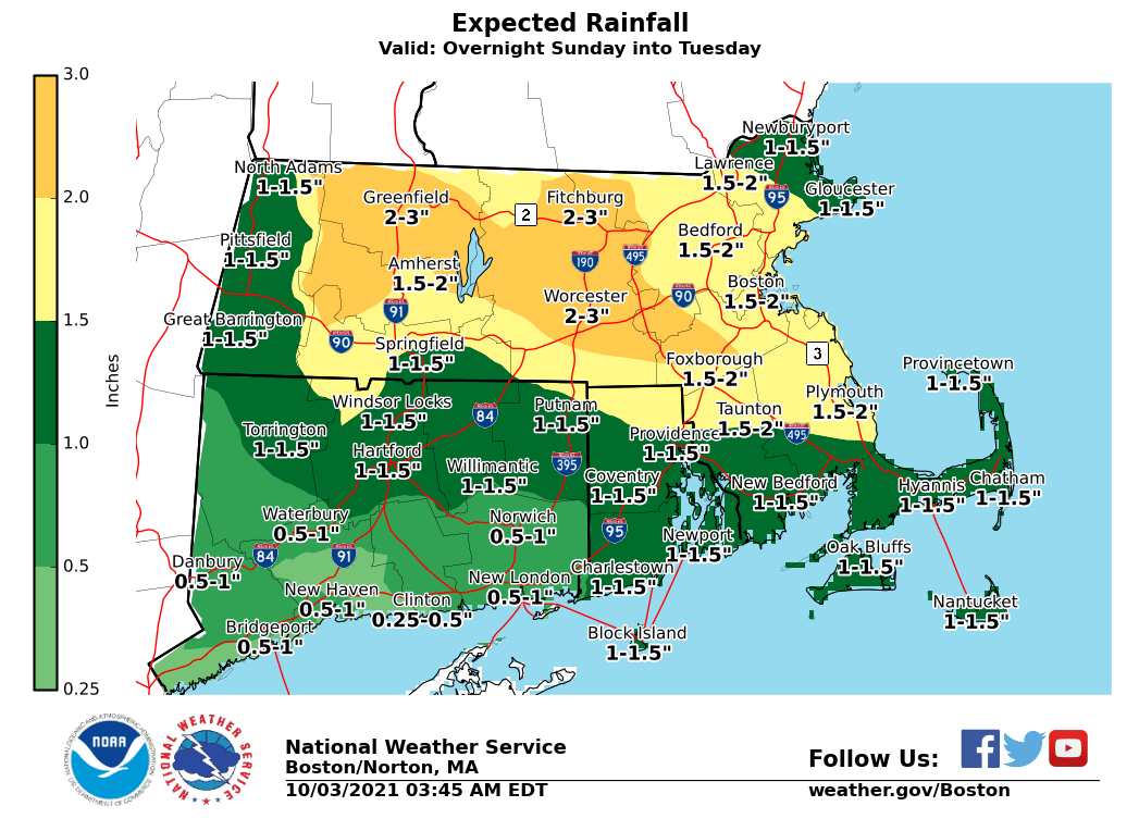
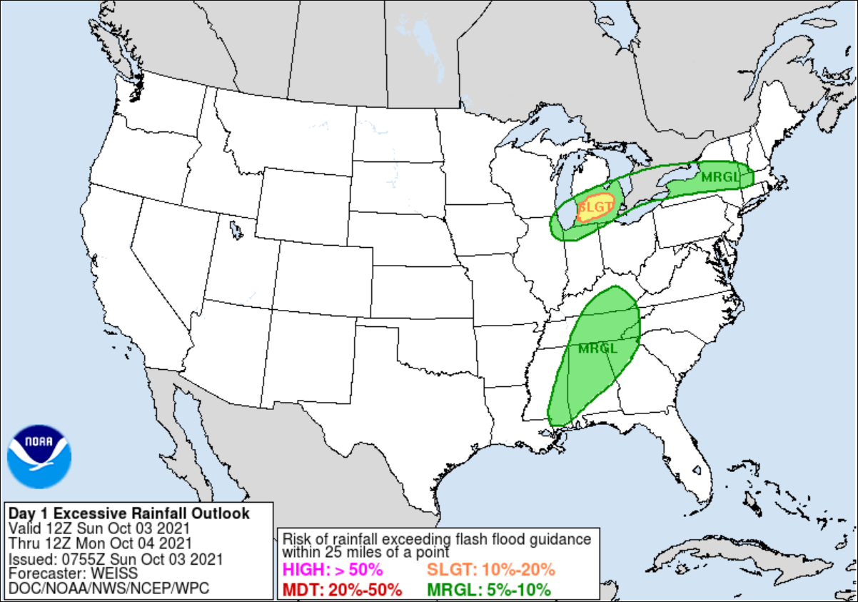
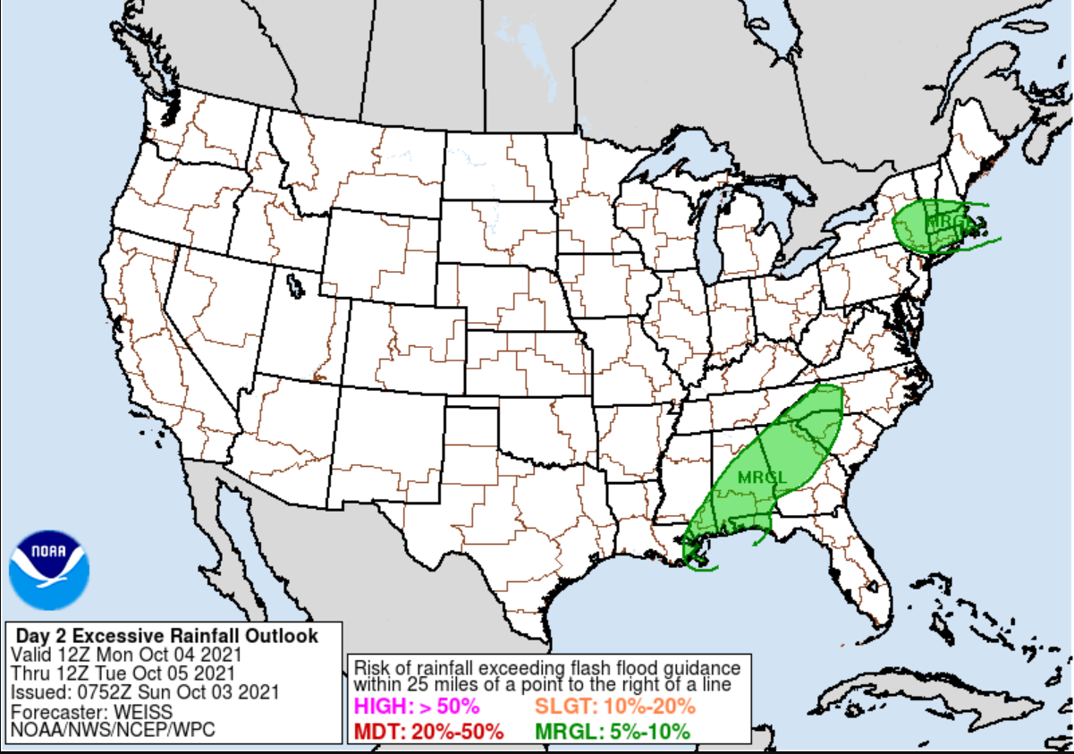
Good morning, Attached is the latest briefing concerning the heavy rainfall late tonight into Tuesday. We have also attached the Day 1 and 2 Excessive Rainfall Outlooks by the Weather Prediction Center. Heavy rain moves into Western MA and CT late tonight before overspreading the rest of Southern New England by Monday. The threat for widespread flash flooding is low given the prolonged nature of the event. Thank you, Meteorologists: Rodney Chai and Bill Babcock If you have any questions or would like more information, don't hesitate to contact us via this email address, on NWSChat <https://nwschat.weather.gov/>, or at the following: National Weather Service Boston/Norton, MA 46 Commerce Way Norton, MA 02766 508.622.3280 Website <http://www.weather.gov/boston> | Facebook <http://www.facebook.com/NWSBoston> | Twitter <http://www.twitter.com/NWSBoston>