
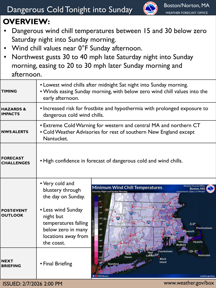
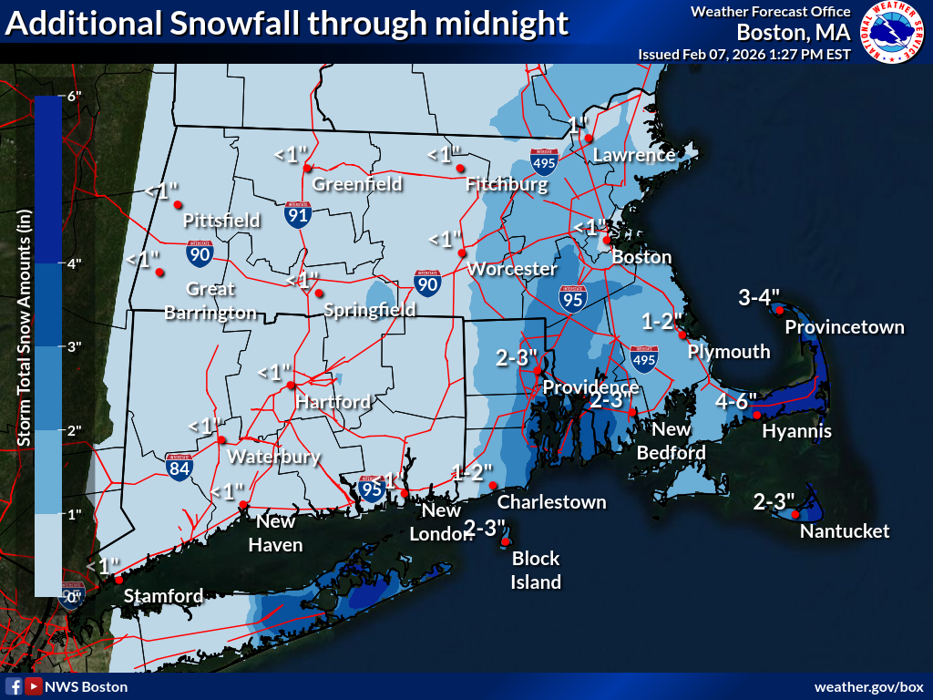
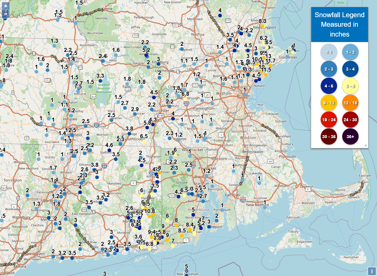
Good afternoon everyone, Thinking has not changed regarding the dangerous cold expected this evening into Sunday morning. The one pager has been updated, and we have added a map showing additional snow expected through midnight (though snow should end for everyone outside of Cape Cod/Nantucket by around 7PM). We've also attached a map indicating observed snowfall so far, and you can find a running list of snowfall reports here <https://forecast.weather.gov/product.php?site=box&issuedby=BOX&product=PNS> . Thank you, Bryce Williams and Kyle Pederson. If you have any questions or would like more information, please don't hesitate to contact us. You can reach us via: email: box.operations@noaa.gov phone: 508.622.3280 Slack/NWSChat 2.0 <https://nwschatws.slack.com/> (for approved partners) social media: Website <http://www.weather.gov/boston> | Facebook <http://www.facebook.com/NWSBoston> | Twitter <http://www.twitter.com/NWSBoston>