
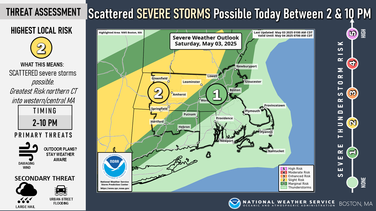
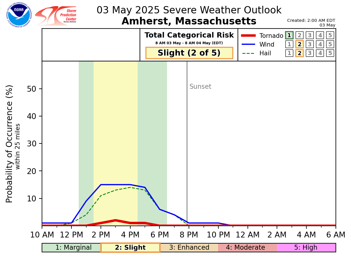
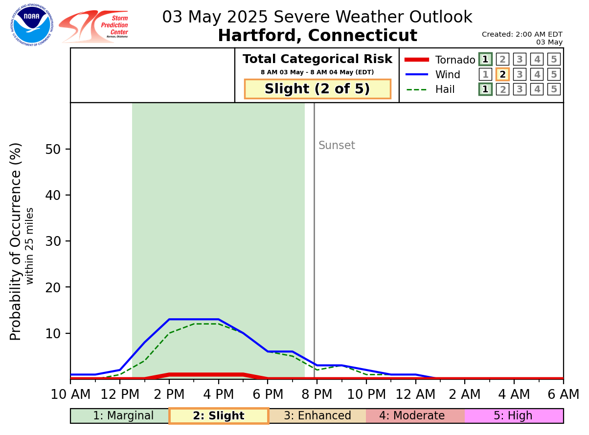
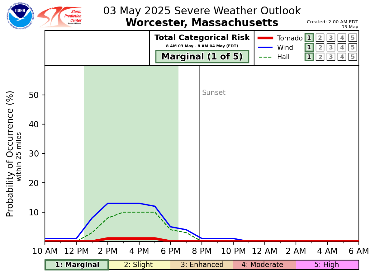
Good morning everyone... Attached is a brief one-pager on the potential for scattered severe thunderstorms northwest of I-95 between 2 and 10 pm this evening. The greatest risk appears to be across western/central MA perhaps reaching southward into portions of northern CT. The main severe weather threat will be for locally damaging straight line wind gusts with secondary concerns for hail along with heavy rain/urban street flooding. We have gone ahead and attached the one-pager along with the Severe Weather Outlook today. Also, we have attached some new experimental severe weather timing graphics for Amherst & Worcester MA as well as Hartford CT. These graphics highlight the probability with respect to time of severe weather occurring within 25 miles of that particular location. It is broken down by the severe weather type...which in this case is mainly damaging wind gusts followed by hail. We would love to hear your feedback on these products and if it is something you would like to see in the future. Thank You! Meteorologist: Hayden Frank If you have any questions or would like more information, please don't hesitate to contact us. You can reach us via: email: box.operations@noaa.gov phone: 508.622.3280 Slack/NWSChat 2.0 <https://nwschatws.slack.com/> (for approved partners) social media: Website <http://www.weather.gov/boston> | Facebook <http://www.facebook.com/NWSBoston> | Twitter <http://www.twitter.com/NWSBoston>