
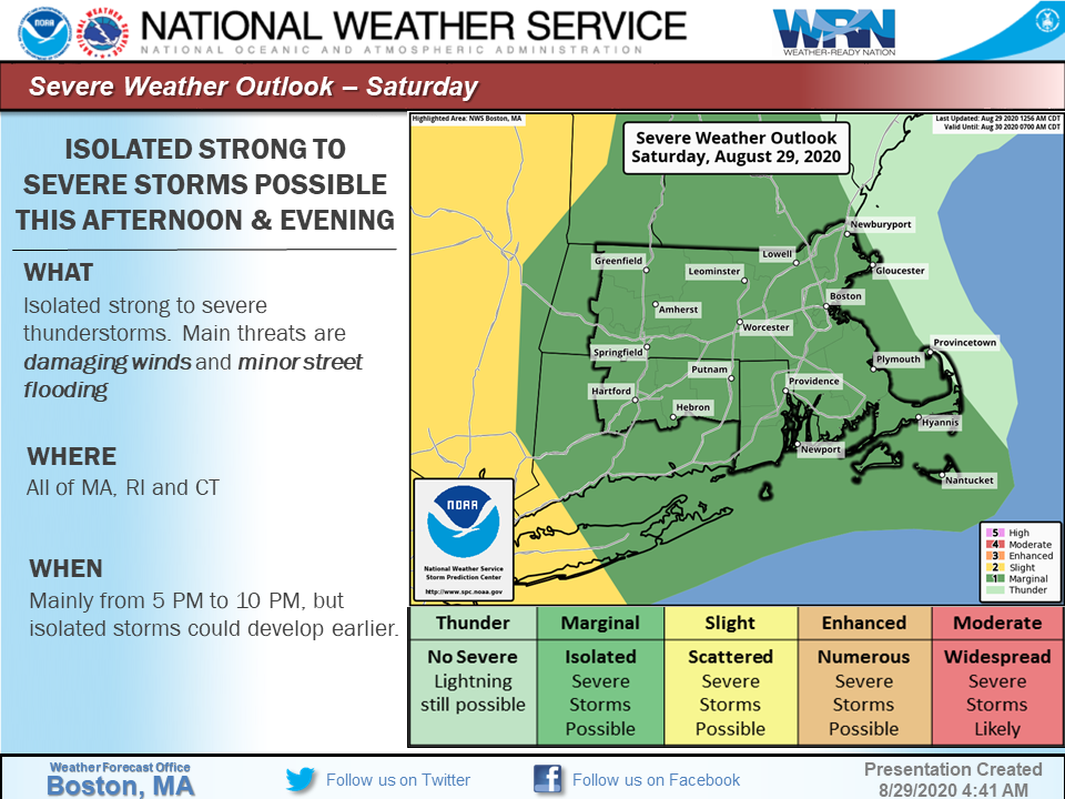
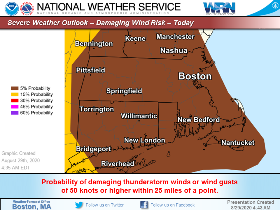
Good morning everyone, Here is the latest on the potential for severe storms today & this evening - *What ...* scattered severe thunderstorms with possible strong to damaging winds *Where ...* western portions of MA and CT including the Greater Hartford and Springfield areas. The greatest risk for severe storms will be west of New England in eastern NY. *When ...* greatest risk is approximately 5 pm to 10 pm with a lower risk before then *Forecast Confidence ...* there is some uncertainty if scattered showers this morning into early this afternoon and associated overcast conditions will reduce the risk of strong to severe storms later today. However if clouds break for sunshine by early this afternoon, the risk of severe storms will increase. *Impacts ... *any damaging winds will be isolated, not widespread. Frank Nocera & Andrew Loconto If you have any questions or would like more information, don't hesitate to contact us via this email address, on NWSChat <https://nwschat.weather.gov/>, or at the following: National Weather Service Boston/Norton, MA 46 Commerce Way Norton, MA 02766 508.622.3280 Website <http://www.weather.gov/boston> | Facebook <http://www.facebook.com/NWSBoston> | Twitter <http://www.twitter.com/NWSBoston>