
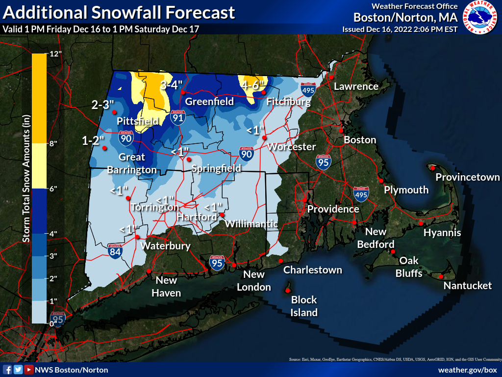
All, We wanted to send you this quick update to primarily pass along that the event is following along fairly closely to our previous forecasts. The highest snow accumulations have been primarily across the higher elevations, especially above 1000-1500 feet. That snow will continue this evening into the early overnight hours. We have added the far northwest corner of Middlesex County MA to our Winter Weather Advisory since the highest elevation towns (Ashby and Townsend) will see several inches of snow this evening. Rain will continue elsewhere. Winds will be diminishing this evening. As the storm winds down well after midnight and during Saturday morning, a brief period of light snow is expected even at lower elevations, however no significant accumulation is expected. Attached to this email is a forecast map for what we expect for additional snowfall amounts from this afternoon through early Saturday afternoon. Again, the biggest accumulations will be restricted to the highest elevation locations. If you have any questions or would like more information, don't hesitate to contact us via this email address. Thank You, Andy Nash, Torry Gaucher, Andrew Loconto