
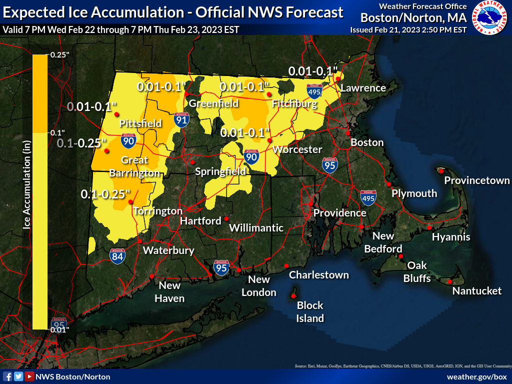
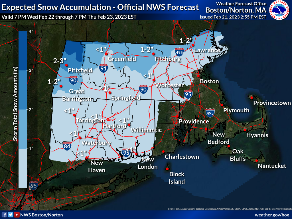
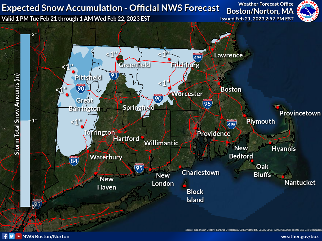
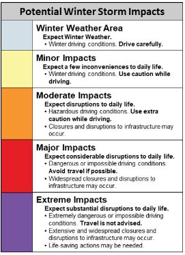
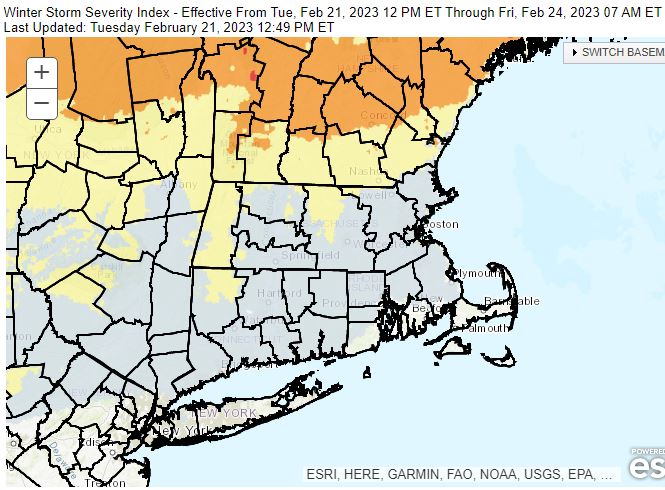
Good afternoon, The first of two minor events passed us by earlier today, with the second arriving this evening. Expecting up to 2" of snow across the higher terrain of MA, with mainly rainfall elsewhere. Attached is a model simulated radar loop, not expected to be exact, but to give you a feel for the overall precipitation type, timing and evolution of precipitation this evening. Also, attached is a map with potential snowfall for this evening. A more significant winter weather event is possible Wednesday night through Thursday night, when a mix of snow, sleet and freezing rain is expected to impact the region, with the greatest impact likely across northern Massachusetts. Slippery travel may impact the Thursday morning commute. The attached map (potential weather impacts) indicates the area with the greatest impact likely across northern MA. Bryce Williams and Matthew Belk If you have any questions or would like more information, don't hesitate to contact us via this email address, on NWSChat <https://nwschat.weather.gov/>, or at the following: National Weather Service Boston/Norton, MA 46 Commerce Way Norton, MA 02766 508.622.3280 Website <http://www.weather.gov/boston> | Facebook <http://www.facebook.com/NWSBoston> | Twitter <http://www.twitter.com/NWSBoston>