
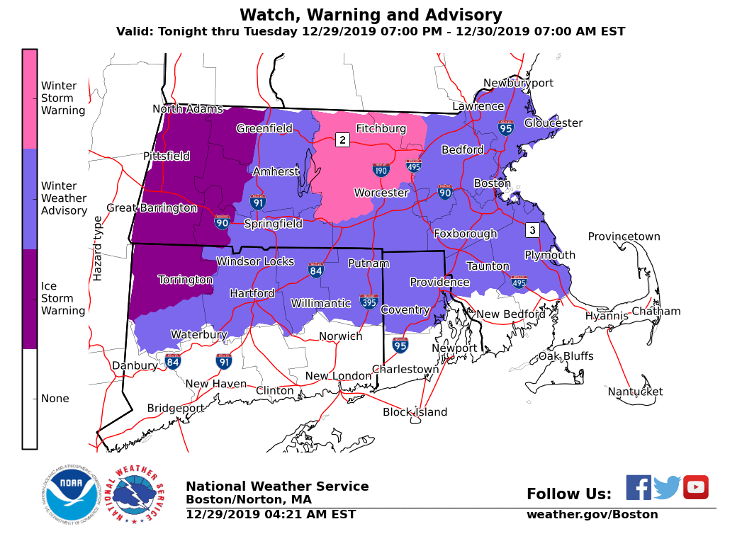
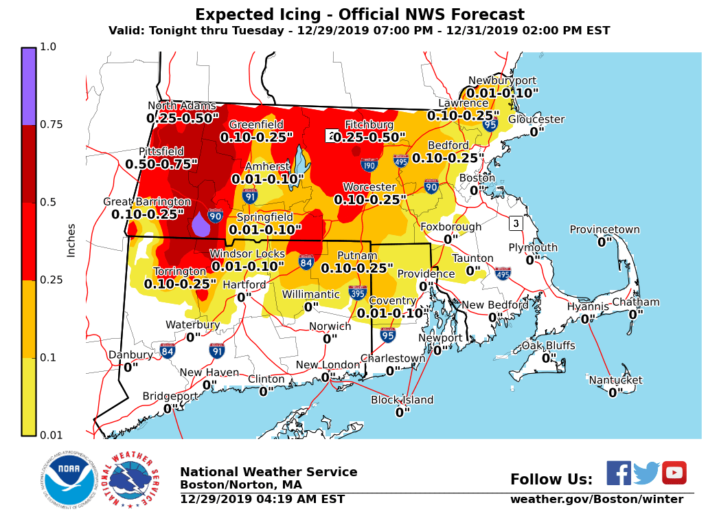
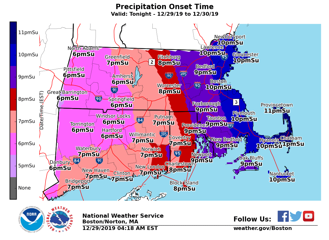
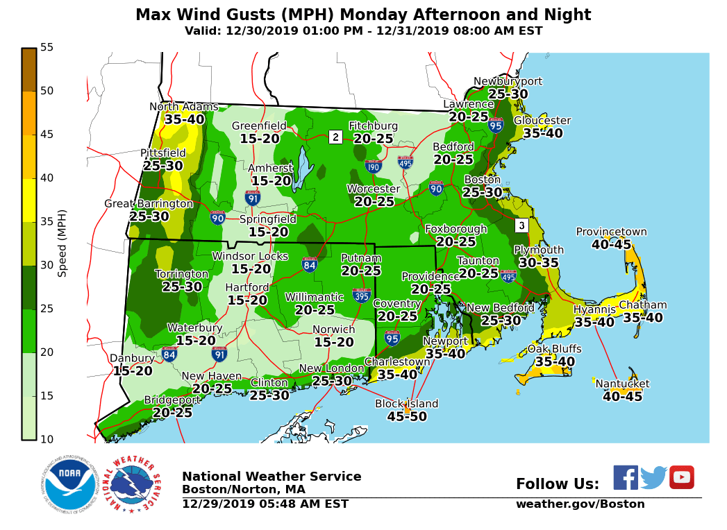
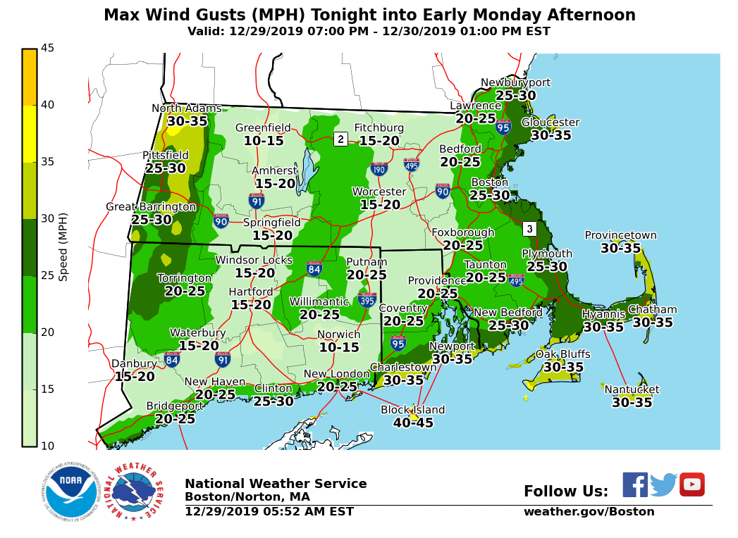
Good morning everyone, Here is the latest forecast information on a complicated storm system bringing concerns for significant higher-elevation icing and wintry mix of precipitation types for Southern New England tonight into Tuesday. *What Has Changed:* *Winter Headlines (In Effect Tonight through Tuesday AM, All Areas):* Ice Storm Warnings *for the eastern slopes of the Berkshires.* Predominantly freezing rain of a prolonged-duration is expected here, with the *most significant icing and impacts* expected for these locations. *Winter Storm Warning* *for northern Worcester County into northwest Middlesex County in MA. *Wintry mixture of freezing rain and sleet here, though greatest impact from freezing rain. *Significant icing and impacts* expected. Winter Weather Advisories *for most of the remainder of Southern New England (except southern RI, southern Plymouth & Bristol Counties in MA into Cape Cod and the Islands)*. Mix of precip types for these areas, with lesser though still impactful accretions of freezing rain and sleet (with snow possible northern MA). *Marine Headlines:* *Gale Warnings* for southern coastal offshore waters. In effect Monday 7 AM into early Tuesday. *Gale Watches* for eastern coastal and offshore waters. In effect Monday Night into Tuesday. =============================================== *Main Weather Concerns: * 1) *Higher Elevation Significant Icing in* *western MA (eastern slopes of the Berkshires) and north-central MA (Worcester County hills into northwest Middlesex County) developing tonight thru Monday night*. Icing is expected to begin in tonight and continue into Monday evening, with temperatures around 30 degrees. There is now high confidence in icing accumulations of a half-inch or greater in each area, with *local amounts up to one inch possible in the eastern slopes of the Berkshires where freezing rain is expected to predominate*. 2)* Lower Elevations: Lesser amounts of sleet and freezing rain develop tonight and continue through Monday. *Accumulations of freezing rain and sleet will affect the Monday morning commute. While freezing rain is still expected to continue across interior MA and northern CT for the afternoon commute, a wintry mix of sleet to rain is expected towards the MA East Coast. Icing amounts range from a light glaze to a quarter-inch, though *may locally be near a half-inch in spots N/W of I-84 and I-495 if freezing rain can remain more prolonged*. 3) A* brief period of snow* is possible at the end of the storm late Monday night into Tuesday, especially in northern Massachusetts near the New Hampshire border. Up to a couple inches of snow is expected in these areas. 4) *Strong east to northeast winds* are expected over the coastal waters and along the South Coast Monday night. Limited impact expected. =============================================== *Confidence...and what could still change:* We have high confidence that this storm system will occur and produce a wintry mix. Confidence has also increased on the potential for significant icing and impact in higher-elevation areas (e.g. those areas currently in Ice Storm and Winter Storm Warnings). Confidence on the distribution/duration of precipitation types is moderate outside of the two Ice Storm and Winter Storm Warning areas. This may result in further significant change in snow/sleet and ice accumulations - especially across northeast MA, southern interior MA on into northern CT. Supporting graphics are attached, including the current Winter headlines, Storm Total Icing, Onset, peak wind gusts tonight into Monday afternoon (e.g. period when icing is greatest), and peak wind gusts for Monday evening. Meteorologists: Andrew Loconto and Frank Nocera If you have any questions or would like more information, don't hesitate to contact us via this email address, on NWSChat <https://nwschat.weather.gov/>, or at the following: National Weather Service Boston/Norton, MA 46 Commerce Way Norton, MA 02766 508.622.3280 Website <http://www.weather.gov/boston> | Facebook <http://www.facebook.com/NWSBoston> | Twitter <http://www.twitter.com/NWSBoston>