
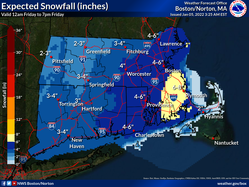
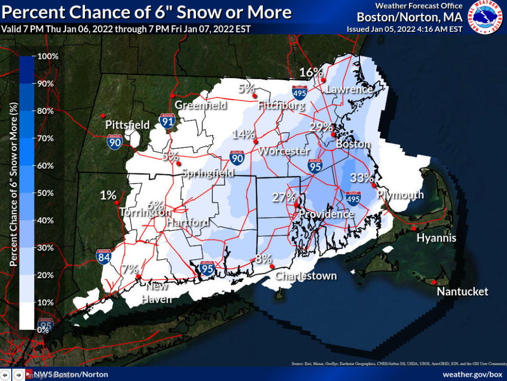
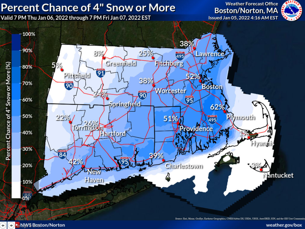
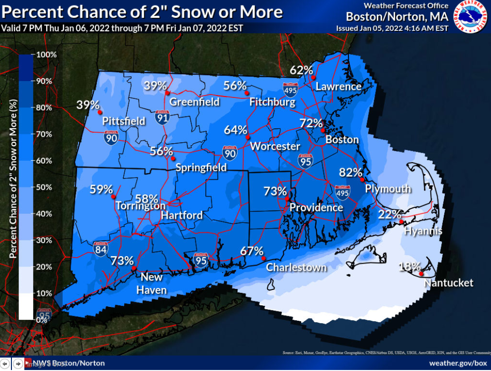
Good morning, This is a correction to the email sent earlier. The message conveyed in the previous email remains the same, but the attached graphics indicating the percent chance of 2, 4, and 6 inches of snow are more up to date. We apologize for any confusion. The message from the previous email is as follows... *Good morning,* *Attached is a one page briefing and supporting graphics regarding a potential winter storm very late Thursday night into Friday morning. At this time we're expecting 3-6 inches of snow for eastern MA and RI and around 2-4 inches of snow for CT and the areas west of Worcester. The graphics included are the chances of snow exceeding 2, 4, and 6 inches as well as the official forecast. Please note that the area highlighting 6-8 inches in the official forecast map is expected to be closer to 6 inches than 8 inches. We'll provide an update later today when more information becomes available.* Thank you, Rob Megnia If you have any questions or would like more information, don't hesitate to contact us via this email address, on NWSChat <https://nwschat.weather.gov/>, or at the following: National Weather Service Boston/Norton, MA 46 Commerce Way Norton, MA 02766 508.622.3280 Website <http://www.weather.gov/boston> | Facebook <http://www.facebook.com/NWSBoston> | Twitter <http://www.twitter.com/NWSBoston>