
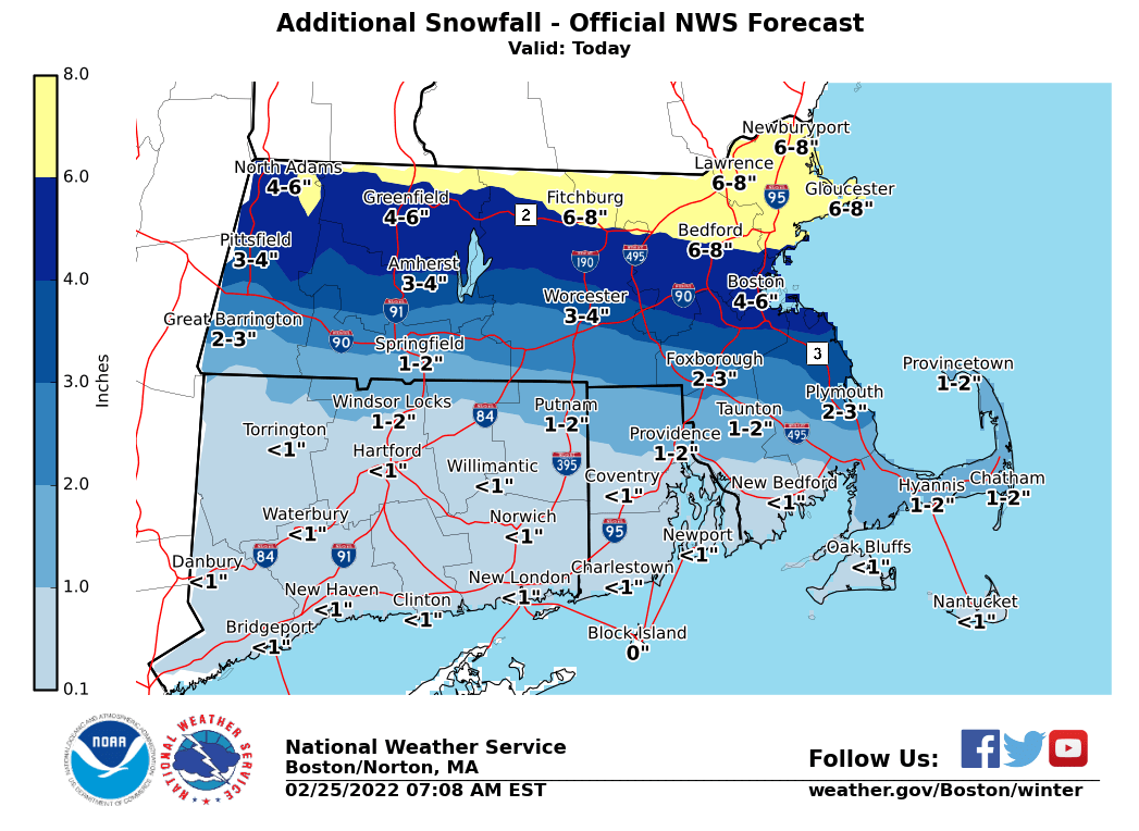
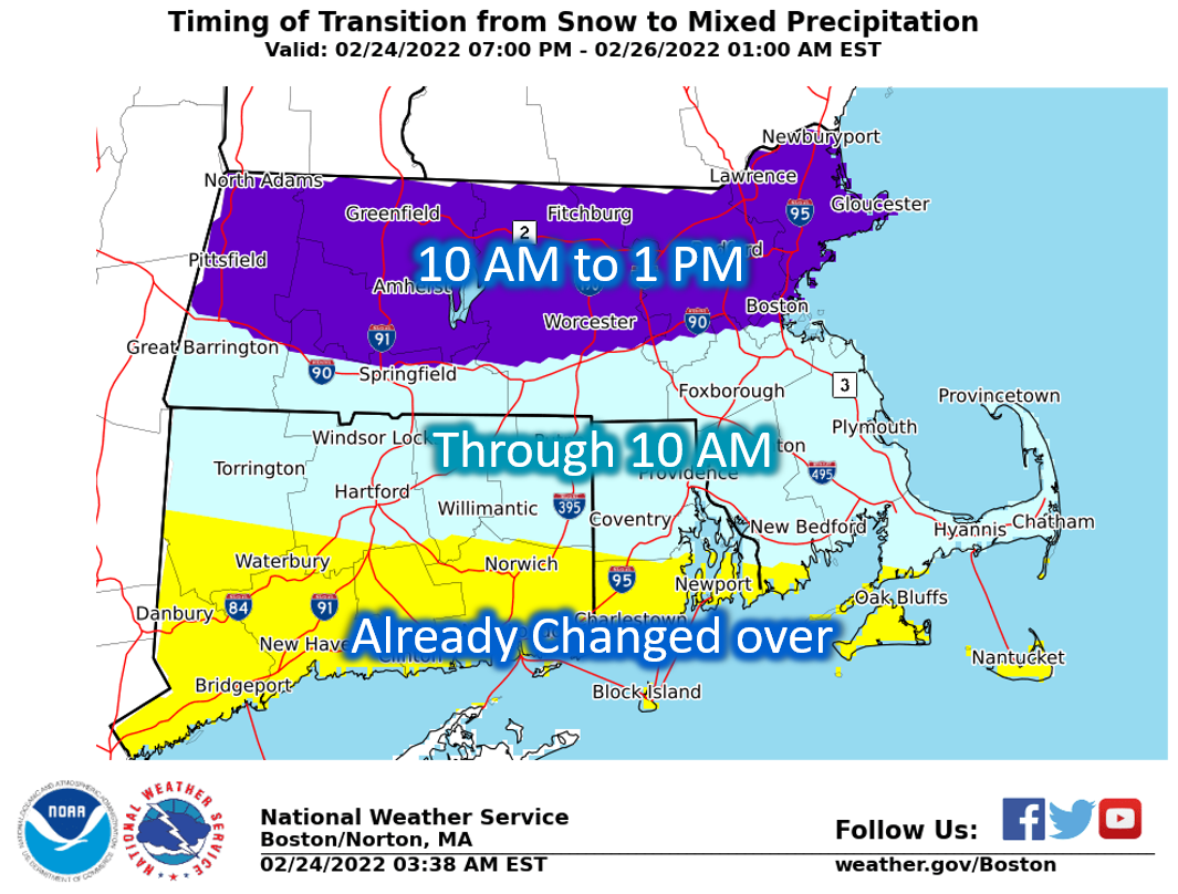
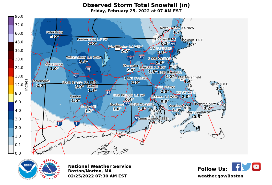
Good morning everyone, The changeover from snow to sleet has occurred faster than expected, so we are providing an updated additional snowfall forecast as well as transition timing map. Also attached is an observed snowfall map through 730 AM. *What has changed:* 1. Reduced the amount of snow, especially south of the Pike where many locations have already seen a changeover to sleet. *Additional note:* 2. The previous messaging regarding the second round of snow this afternoon into evening for Central/Eastern MA and RI, as well as the flash freeze threat remains the same. Thank you. Meteorologist Rodney Chai If you have any questions or would like more information, don't hesitate to contact us via this email address, on NWSChat <https://nwschat.weather.gov/>, or at the following: National Weather Service Boston/Norton, MA 46 Commerce Way Norton, MA 02766 508.622.3280 Website <http://www.weather.gov/boston> | Facebook <http://www.facebook.com/NWSBoston> | Twitter <http://www.twitter.com/NWSBoston>