
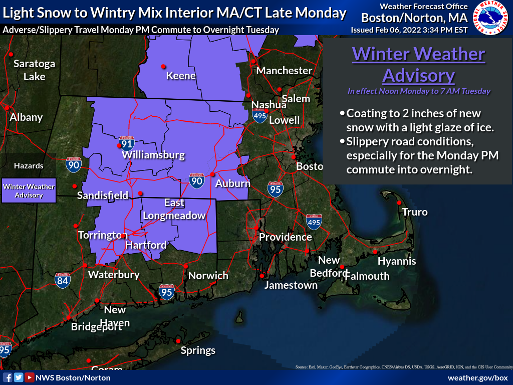
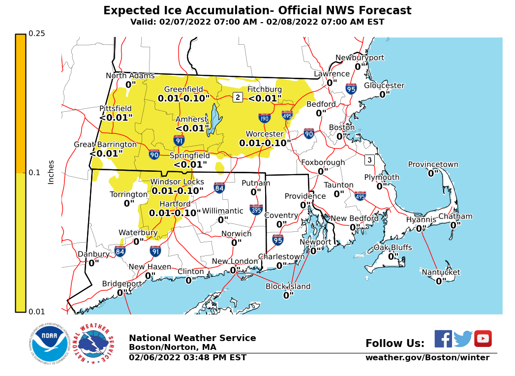
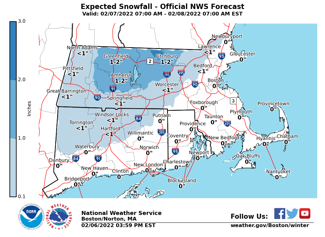
Good afternoon, Please find attached an initial one-page briefing packet and supporting graphics for a light snow to wintry mix event expected for mainly interior Massachusetts and northern Connecticut late Monday into the early Tuesday period. Up to a couple inches of new snow and a light glaze of icing is currently expected. Greatest impact for central and western Massachusetts into northern Connecticut is to travel, especially around the Monday PM commute into the evening/overnight. While there is high confidence on a light-accumulation event, temperatures between 30-34F carries some uncertainty on road conditions (e.g. mainly wet vs mainly icy). For eastern Massachusetts and Rhode Island, we expect this to be a mainly rain event with nil impact, with high confidence. Expect our next briefing to be sent by *6 AM Monday*. Thank You! Meteorologists: Andrew Loconto, Bill Leatham and Hayden Frank If you have any questions or would like more information, don't hesitate to contact us via this email address, on NWSChat <https://nwschat.weather.gov/>, or at the following: National Weather Service Boston/Norton, MA 46 Commerce Way Norton, MA 02766 508.622.3280 Website <http://www.weather.gov/boston> | Facebook <http://www.facebook.com/NWSBoston> | Twitter <http://www.twitter.com/NWSBoston>