
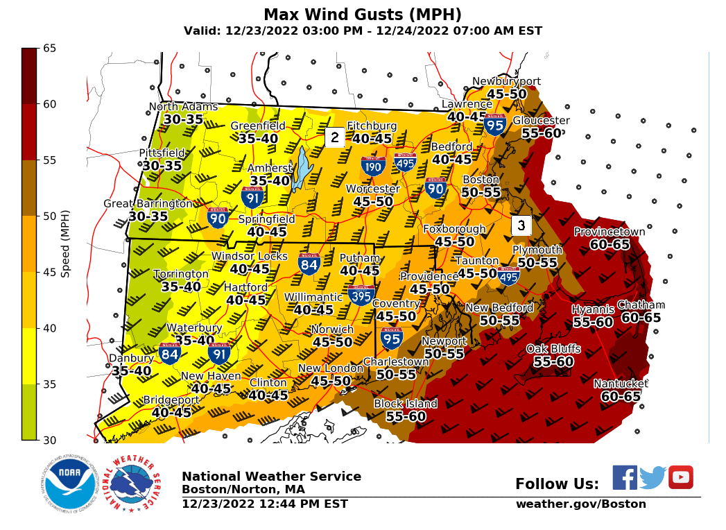
Good afternoon everyone, Just wanted to provide a quick email update. The forecast remains on track. There is a little bit of a lull in the strong winds as of 12 to 1 PM, but we will see another surge of gusty winds between 4-7 PM of 40-60 mph gusts (graphic attached). The highest gusts are expected across eastern areas. Precipitation will taper off mid to late this afternoon ending as non accumulating snow. Ocean effect snow showers will persist across the south coast on Saturday and into Sunday with light accumulation. If you have any questions or would like more information, don't hesitate to contact us via this email address, on NWSChat <https://nwschat.weather.gov/>, or at the following: National Weather Service Boston/Norton, MA 46 Commerce Way Norton, MA 02766 508.622.3280 Website <http://www.weather.gov/boston> | Facebook <http://www.facebook.com/NWSBoston> | Twitter <http://www.twitter.com/NWSBoston>