
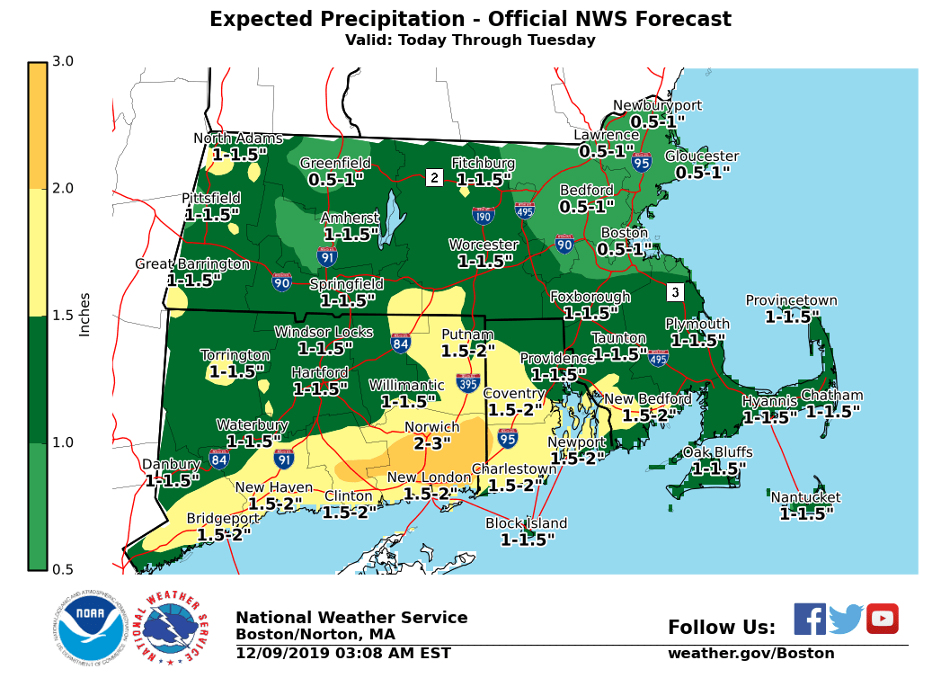
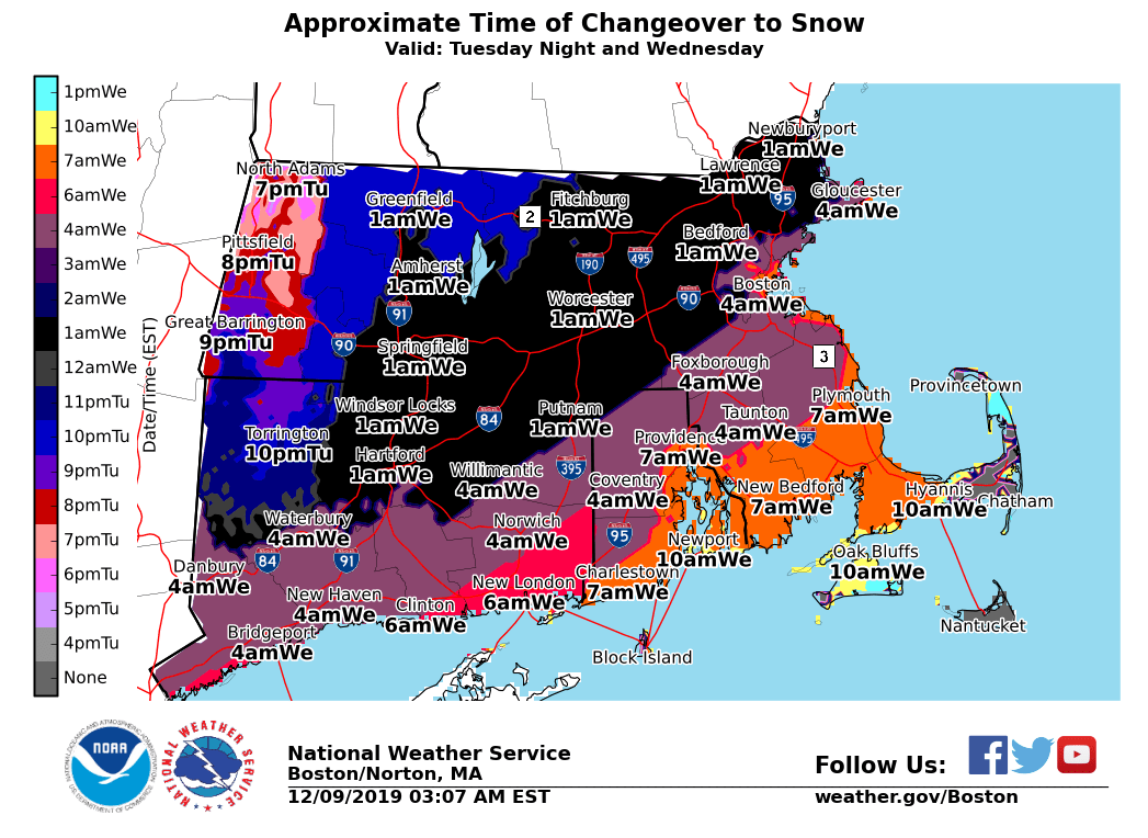
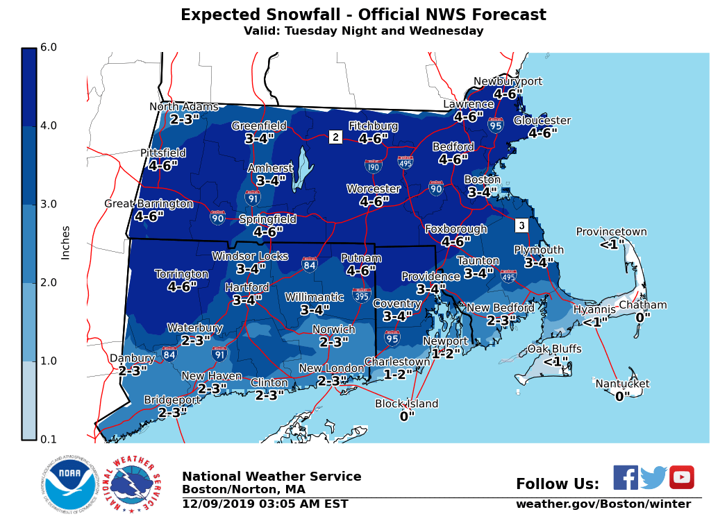
Good Morning, This is an update to yesterday afternoon's email on potential weather hazards today through Wednesday. Overall, little has changed aside from a slight increase in snowfall amounts Wednesday. We have attached forecast graphics of rainfall totals through tonight as well as snow accumulations and an approximate rain-to-snow changeover time for Tuesday Night and Wednesday. *Today and Tonight: Rain (Heavy at Times)* Heavy rain later today and tonight will bring rainfall totals of 1 to 2 inches to much of southern New England with possibly as much as 3 inches in a few locations near the South Coast. In addition, unseasonably mild temperatures in the 50s will lead to significant snow melt. The combination of rain and snowmelt is not forecast to result in flooding of rivers or streams. However, minor urban and poor drainage nuisance flooding is possible especially where storm drains are clogged. Areas of standing water from rain and snowmelt will affect the evening commute. *Confidence:* High. Heaviest rains are expected to the south of where snowpack is greatest, and it would take heavier rainfall further to the north to produce a greater flood threat, which is unlikely at this time. *Tuesday Night into Wednesday*: *Accumulating Snow* Rain will change to snow late Tuesday night into Wednesday morning. Snow is expected to end by Wednesday afternoon. Much of southern New England should see a plowable snowfall, with the exception of Cape Cod and the Islands and perhaps the immediate South Coast. As temperatures fall during the night, wet pavement may freeze and become slick. This may result in slow travel into the Wednesday morning commute. *Confidence: *Moderate. The axis of heaviest snowfall remains in question, which could alter snowfall totals (up or down) on the northwestern or southeastern end. Changeover timing is approximate and will depend on how quickly colder air advances southeast. **Note:* Please consider the snow accumulation and onset time graphics as *preliminary* and are subject to further adjustments. Meteorologists: Joe DelliCarpini and Eleanor Vallier-Talbot If you have any questions or would like more information, don't hesitate to contact us via this email address, on NWSChat <https://nwschat.weather.gov/>, or at the following: National Weather Service Boston/Norton, MA 46 Commerce Way Norton, MA 02766 508.622.3280 Website <http://www.weather.gov/boston> | Facebook <http://www.facebook.com/NWSBoston> | Twitter <http://www.twitter.com/NWSBoston>