
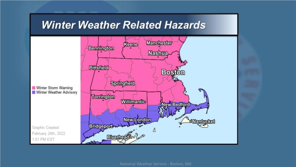
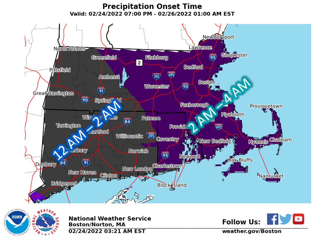
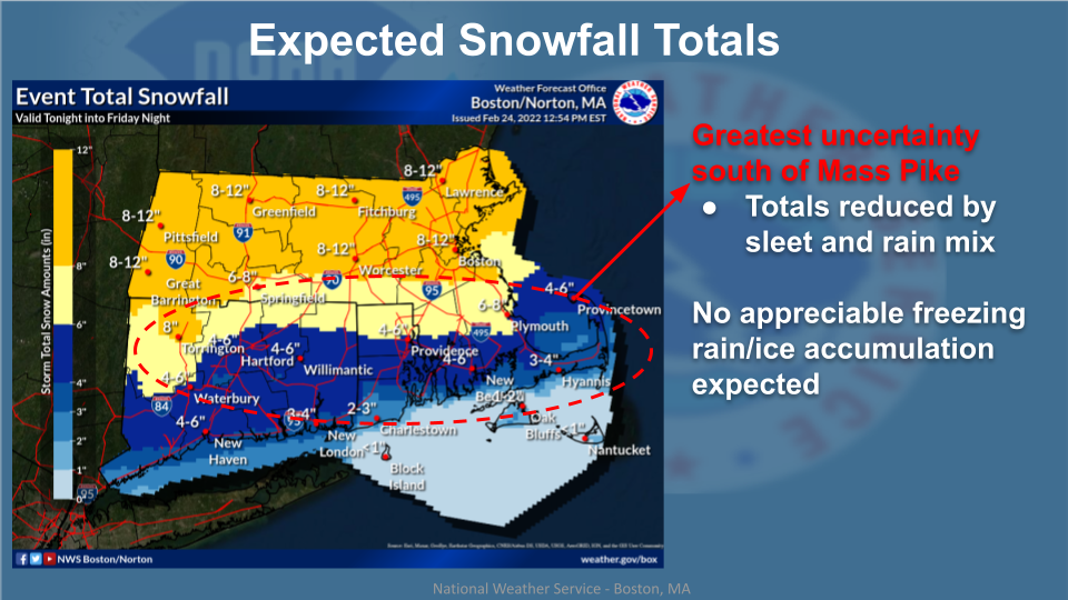
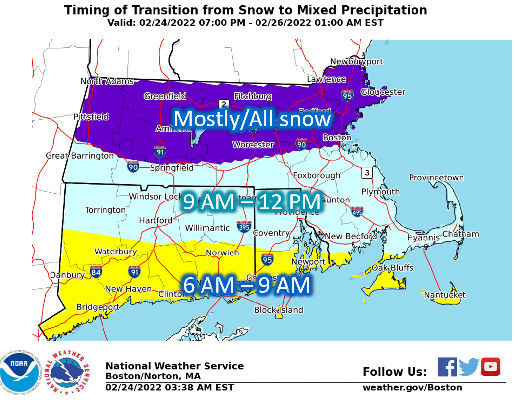
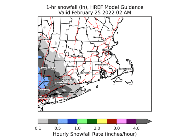
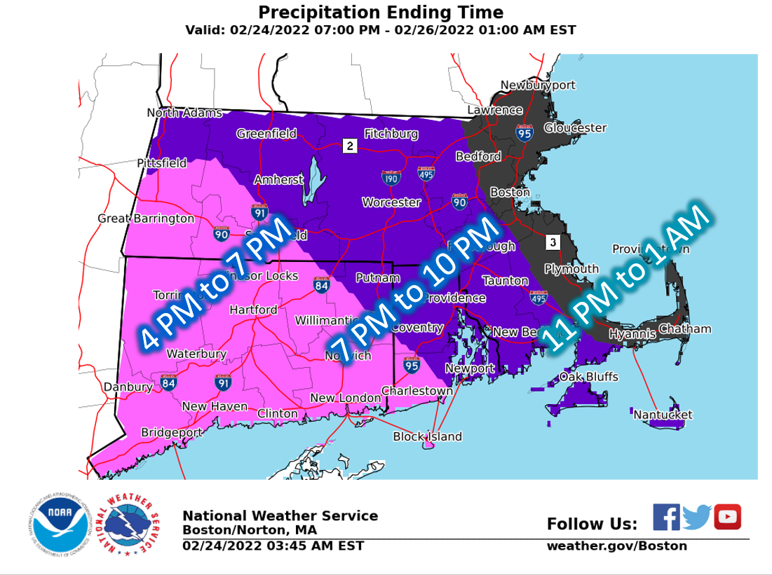
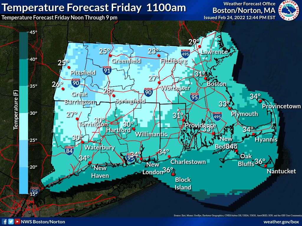
Good afternoon everyone, *What has changed:* winter storm watches have been converted to winter storm warnings across northern CT/RI and nearby southeast MA. Winter storm watches farther south have been converted to winter weather advisories from central RI to the south coast, including south coastal MA and Cape Cod. Attached is our updated winter storm briefing for Friday, including a loop of expected precipitation type, hourly snowfall rates and hourly temperatures Friday, indicating cold air coming back into RI & eastern MA beginning 4-7 pm, resulting in any leftover slush or residual road moisture quickly freezing, hence a flash freeze that may impact the late day commute. Kevin Cadima & Frank Nocera If you have any questions or would like more information, don't hesitate to contact us via this email address, on NWSChat <https://nwschat.weather.gov/>, or at the following: National Weather Service Boston/Norton, MA 46 Commerce Way Norton, MA 02766 508.622.3280 Website <http://www.weather.gov/boston> | Facebook <http://www.facebook.com/NWSBoston> | Twitter <http://www.twitter.com/NWSBoston>