
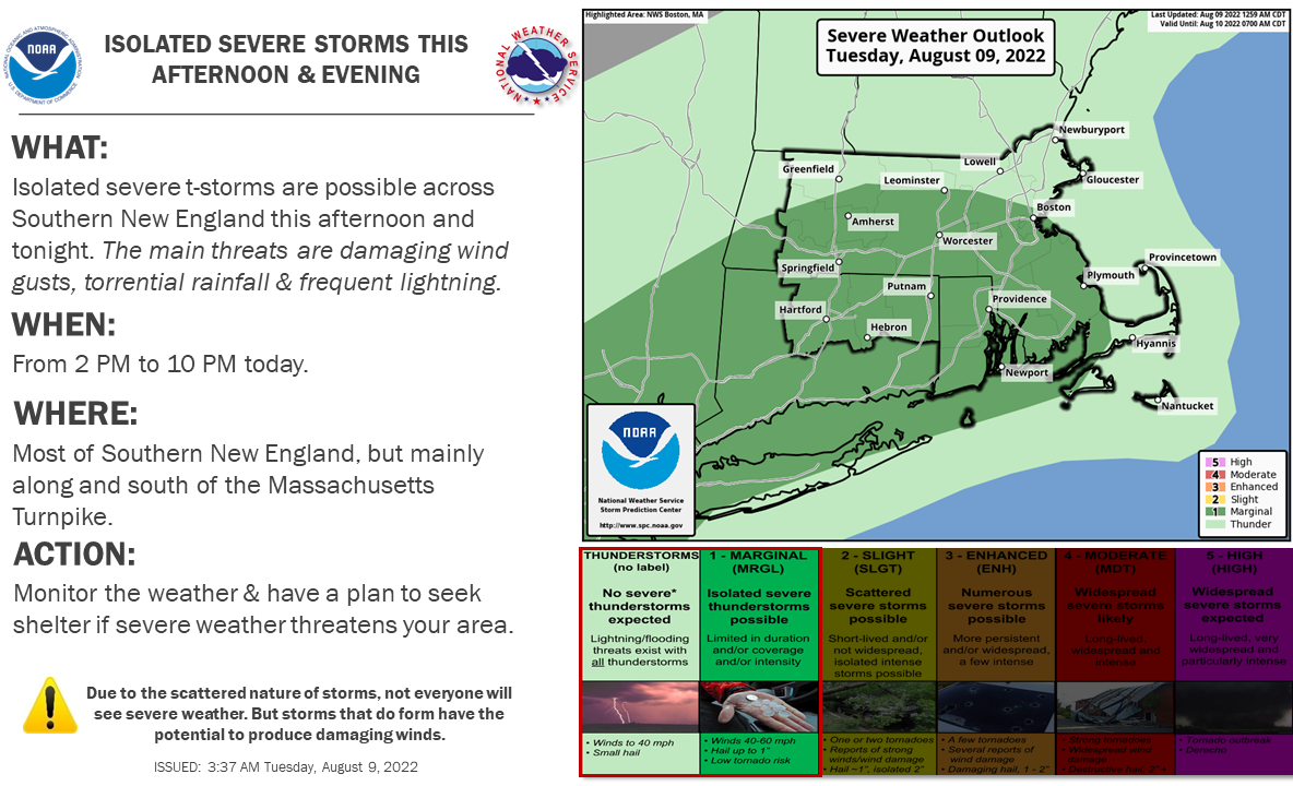
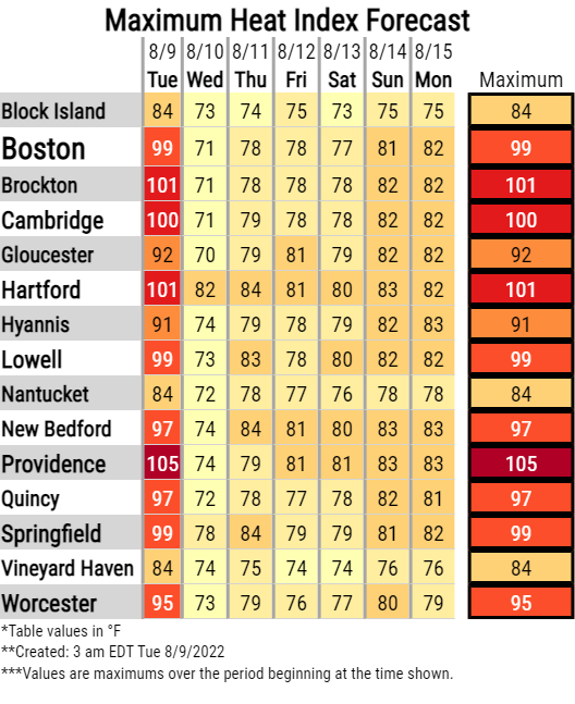
Good morning, Oppressive heat and humidity will continue today with heat indices again expected to reach the mid 90s to lower 100s. Heat Advisories remain in effect through 800 PM today. There remains high confidence that today will be the last day of this stretch of oppressive heat and humidity. In addition, isolated severe thunderstorms are possible in Southern New England between 2 and 10 PM today. As described in the attached graphic, areas along and south of the Massachusetts Turnpike have the greatest risk to experience strong to isolated severe thunderstorms. Localized damaging straight-line winds is the main severe weather risk, but torrential rain and frequent lightning can be expected in thunderstorms. Organized severe weather is not anticipated. While confidence in the area where storms may develop is rated as moderate to high, confidence in the potential for severe weather is low to moderate and it is possible that storms remain at sub-severe levels. Unless there are significant changes to either the oppressive heat forecast and/or the severe thunderstorm forecast, expect this to be the final briefing regarding both hazards. Thank You! Meteorologists: Andrew Loconto and Rodney Chai If you have any questions or would like more information, don't hesitate to contact us via this email address, on NWSChat <https://nwschat.weather.gov/>, or at the following: National Weather Service Boston/Norton, MA 46 Commerce Way Norton, MA 02766 508.622.3280 Website <http://www.weather.gov/boston> | Facebook <http://www.facebook.com/NWSBoston> | Twitter <http://www.twitter.com/NWSBoston>