
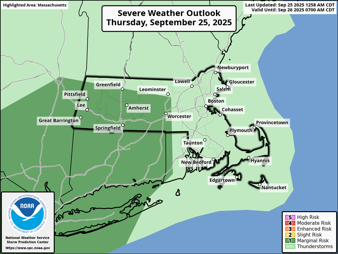
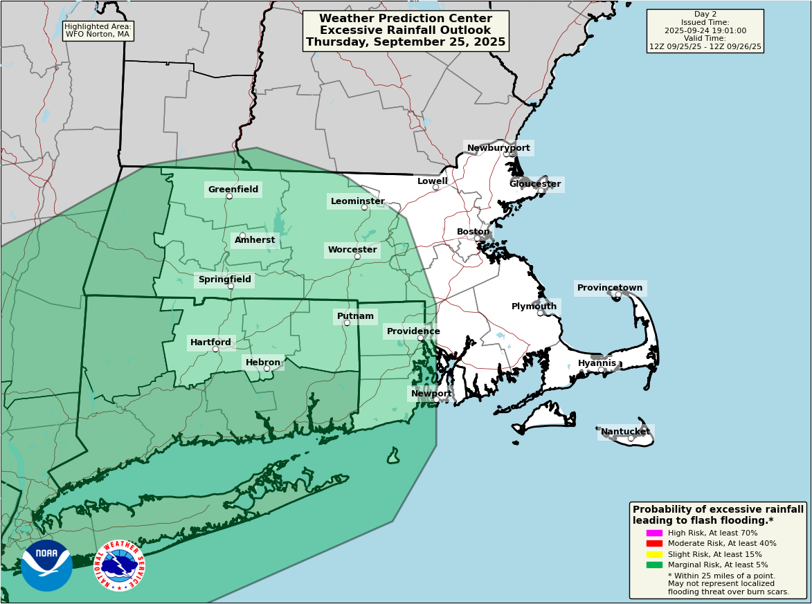
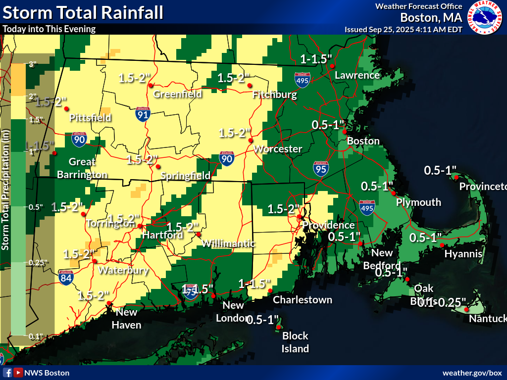
Good morning, Attached is a one pager briefing for the potential heavy rainfall today which may produce localized street flooding. There is still uncertainty where the heaviest rainfall will set up, but the best chance is in the interior with a secondary risk across RI. There is also a low risk for a severe storm with damaging wind and a possible tornado if enough instability can be realized. The best chance for severe weather is across western CT and possibly extending into western MA. The heavy rain threat is expected into this evening, with a diminishing trend overnight. Improving conditions are expected Friday with increasing sunshine. Thank you, Kevin Cadima If you have any questions or would like more information, please don't hesitate to contact us. You can reach us via: email: box.operations@noaa.gov phone: 508.622.3280 Slack/NWSChat 2.0 <https://nwschatws.slack.com/> (for approved partners) social media: Website <http://www.weather.gov/boston> | Facebook <http://www.facebook.com/NWSBoston> | Twitter <http://www.twitter.com/NWSBoston>