
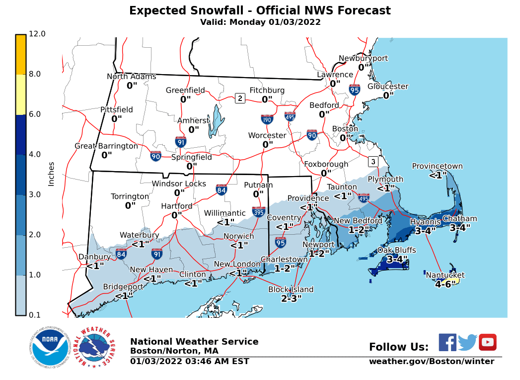
Good morning everyone, The following headlines were issued overnight for accumulating snow this afternoon & early evening, including minor coastal flooding - - A *Winter Storm Warning* for Nantucket - 4 to 7 inches of snow likely - A *Winter Weather Advisory* for Cape Cod, Marthas Vineyard and Block Island - 2 to 5 inches of snow likely - A *Coastal Flood Advisory* for the entire eastern MA coastline, from the NH/MA border to Nantucket - for the late morning into midday high tide cycle. Please see our coastal flood threat display here <https://www.weather.gov/box/coastal?sid=BOX&zoomLevel=8¢erLat=42.17358189832778¢erLng=-71.50177001953126> for additional details - *What we know* - accumulating snow will overspread the Islands and Cape Cod this afternoon and early evening. Heaviest snow with hourly rates of up to one inch are likely late this afternoon & early evening. Roads will become snow covered and slippery. - *What we don't know* - still some uncertainty on the exact northern extent of the accumulating snow. As of now, that line appears to be located somewhere along the immediate south coast. However, a small shift in storm track will have a large impact on snowfall totals from south to north. Therefore, this forecast may need to be updated later this morning. Frank Nocera & Bill Babcock If you have any questions or would like more information, don't hesitate to contact us via this email address, on NWSChat <https://nwschat.weather.gov/>, or at the following: National Weather Service Boston/Norton, MA 46 Commerce Way Norton, MA 02766 508.622.3280 Website <http://www.weather.gov/boston> | Facebook <http://www.facebook.com/NWSBoston> | Twitter <http://www.twitter.com/NWSBoston>