
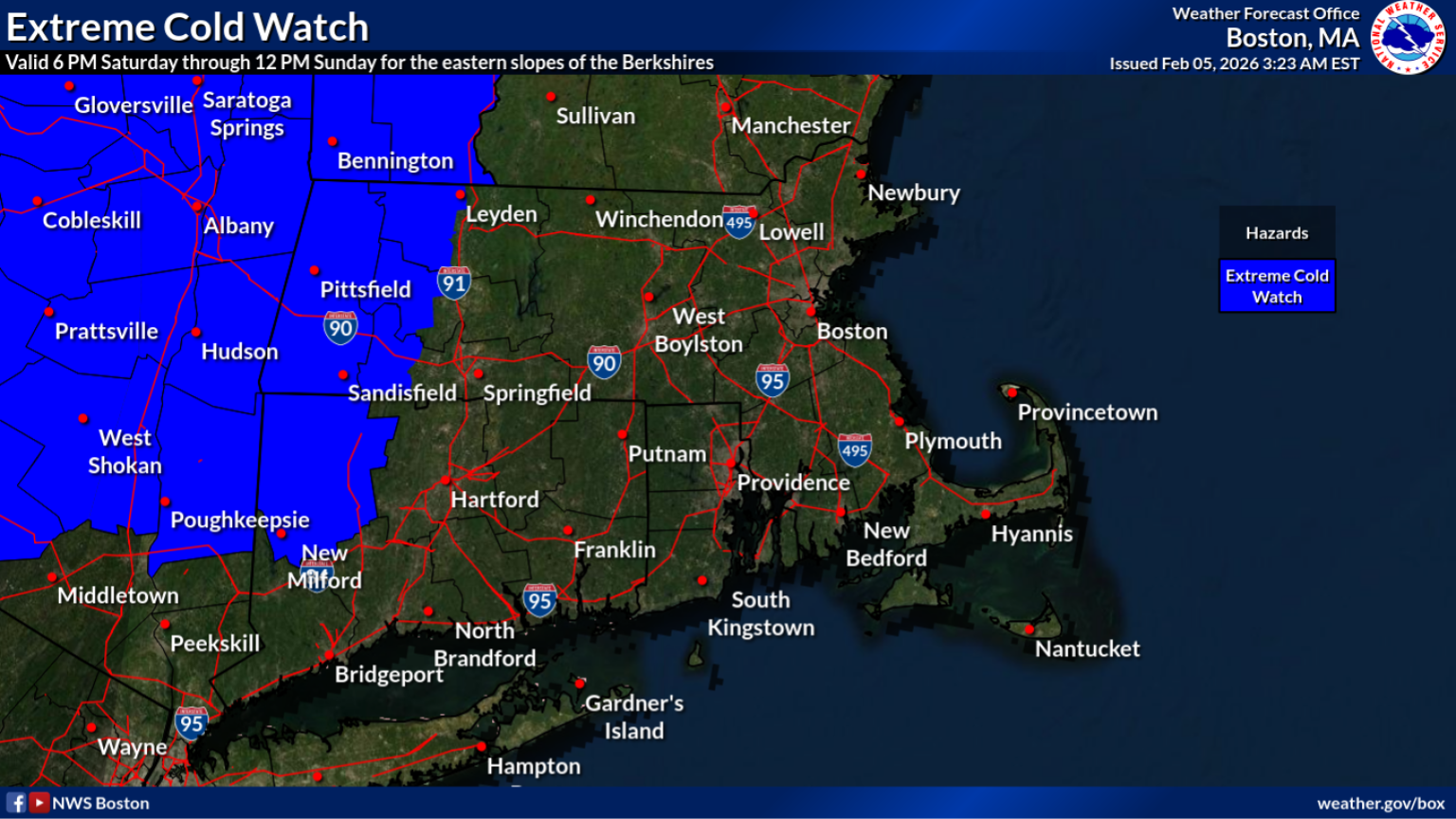
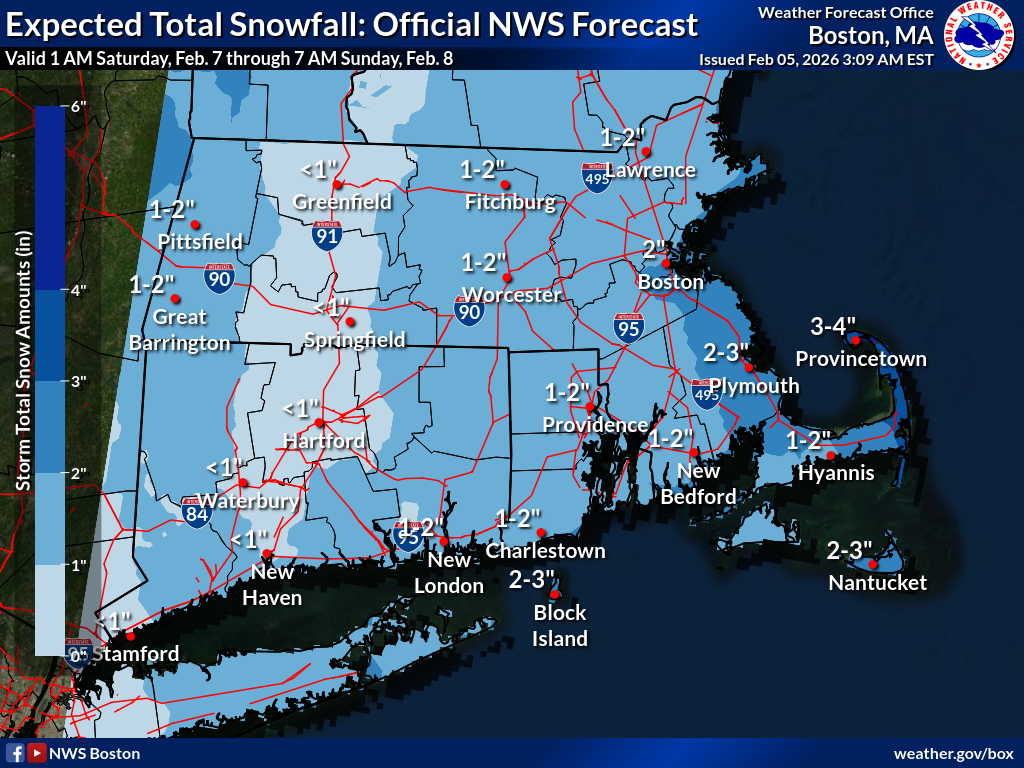
Good morning, Please see the attached one page briefing regarding the dangerous cold expected Saturday night into Sunday. Wind chill values may fall between 15 and 30 below zero and wind gusts between 35 to 45 mph are expected to develop. Confidence continues to increase in these impacts, and an Extreme Cold Watch has been issued for the Berkshires. There is also a chance for light accumulating snow starting Friday night and lasting through Saturday night. Most can expect to see accumulations from a coating to 2", with totals between 2-3" for eastern coastal areas. Parts of the outer Cape could see up to 4". Thank you, Candice Hrencecin and Kevin Cadima If you have any questions or would like more information, please don't hesitate to contact us. You can reach us via: email: box.operations@noaa.gov phone: 508.622.3280 Slack/NWSChat 2.0 <https://nwschatws.slack.com/> (for approved partners) social media: Website <http://www.weather.gov/boston> | Facebook <http://www.facebook.com/NWSBoston> | Twitter <http://www.twitter.com/NWSBoston>