
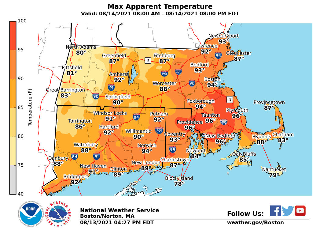
All, Just a short note to update you on tomorrow's (Saturday) forecast. Although it will be warm and humid, it does not appear to be enough for us to issue a heat advisory. Temperatures will top out in the mid to upper 80s, with Heat Index values generally in the upper 80s to lower 90s. Some locations, primarily northern RI and southeastern MA will see heat index values briefly reach the mid 90s. See attached forecast map of maximum heat index values. The thunderstorm risk for tomorrow at this time does not appear to be very large. If any stronger storms develop, we believe that would be across southeastern MA and RI. This will be our last email, unless noteworthy changes to the forecast are made overnight. Have a good weekend. Andy Nash If you have any questions or would like more information, don't hesitate to contact us via this email address, on NWSChat <https://nwschat.weather.gov/>, or at the following: National Weather Service Boston/Norton, MA 46 Commerce Way Norton, MA 02766 508.622.3280 Website <http://www.weather.gov/boston> | Facebook <http://www.facebook.com/NWSBoston> | Twitter <http://www.twitter.com/NWSBoston>