
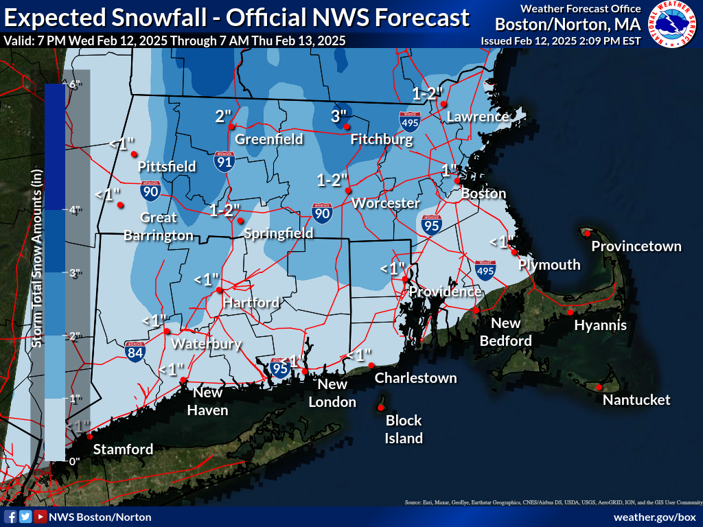
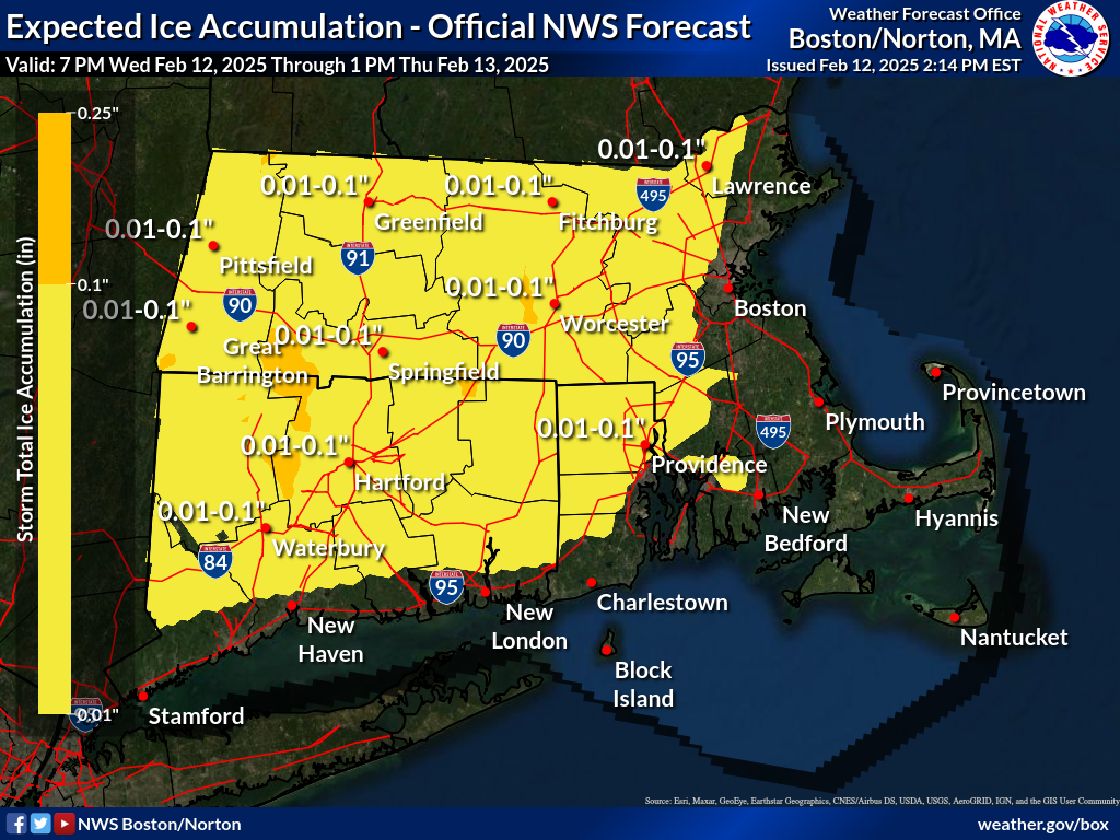
Good afternoon, A quick-moving system will bring minor snowfall and the potential for ice accumulation across interior southern New England late this evening into Thursday. Please see the attached one-page briefing for specific details. Additionally, we've included the latest snowfall and ice accumulation maps. It is worth noting that neighboring NWS Albany has issued a Wind Advisory for Berkshire County from this evening through mid-morning Thursday for downsloping easterly winds of 40 to 50 mph. If you have any questions, please don’t hesitate to reach out! – Hayden Frank & Torry Dooley If you have any questions or would like more information, please don't hesitate to contact us. You can reach us via: email: box.operations@noaa.gov phone: 508.622.3280 Slack/NWSChat 2.0 <https://nwschatws.slack.com/> (for approved partners) social media: Website <http://www.weather.gov/boston> | Facebook <http://www.facebook.com/NWSBoston> | Twitter <http://www.twitter.com/NWSBoston>