
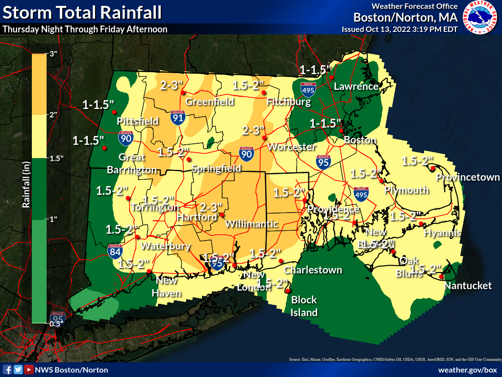
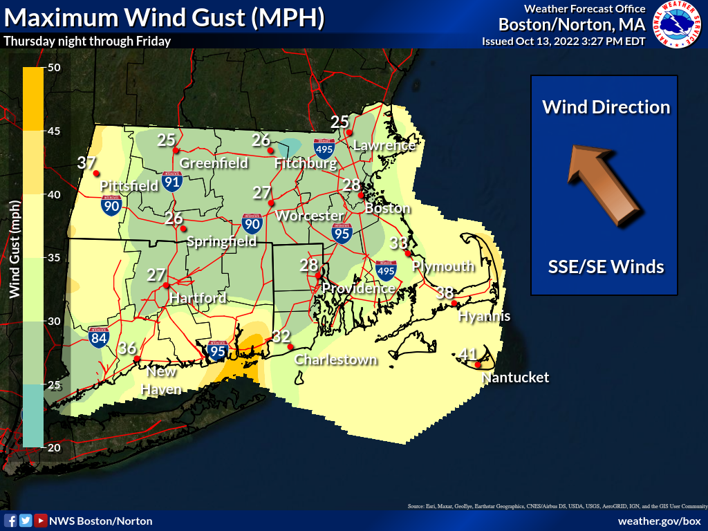
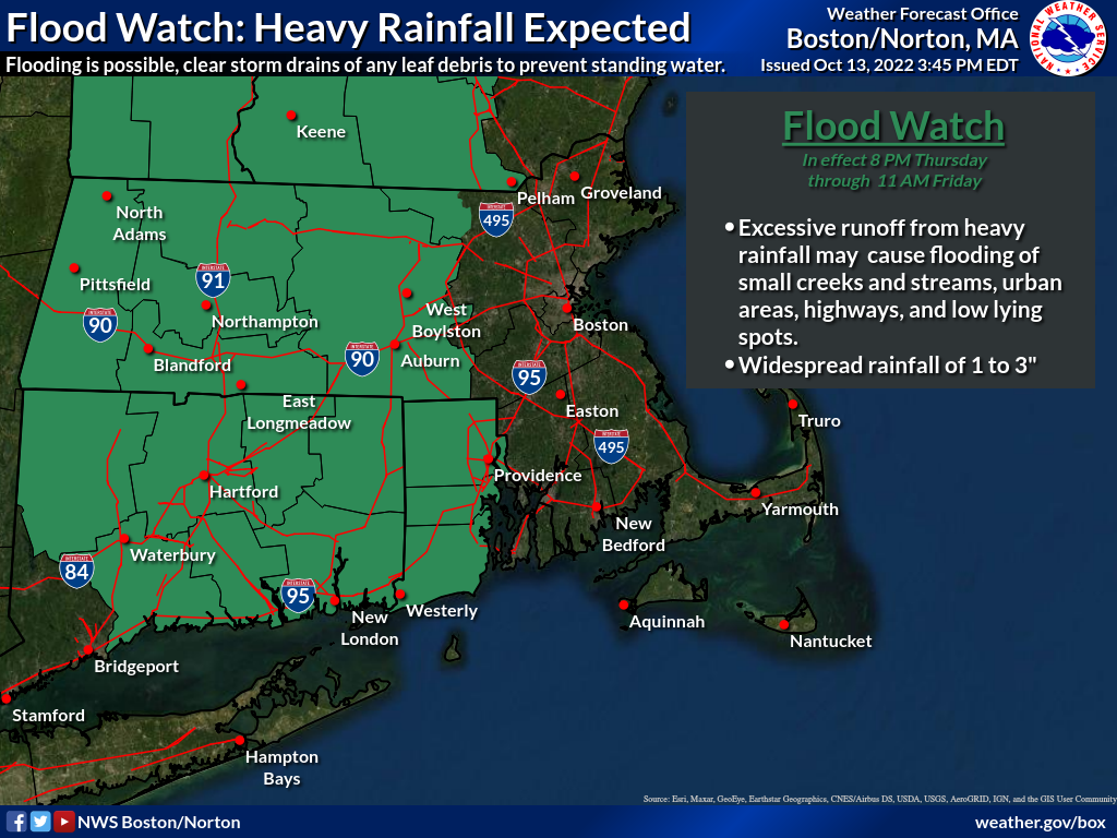
Good afternoon, Attached is the latest one page briefing regarding expected heavy rainfall and strong winds tonight into tomorrow morning. The biggest changes since the last briefing are as follows... - Flood watch in effect for the areas west of the I-495 corridor (see flood watch graphic for specific areas in the watch) - Wind advisory in effect for the South Coast, Cape, Islands, and Cape Ann More details can be found in the one page briefing and supporting graphics. Thanks and have a great afternoon, Rob Megnia and Frank Nocera If you have any questions or would like more information, don't hesitate to contact us via this email address, on NWSChat <https://nwschat.weather.gov/>, or at the following: National Weather Service Boston/Norton, MA 46 Commerce Way Norton, MA 02766 508.622.3280 Website <http://www.weather.gov/boston> | Facebook <http://www.facebook.com/NWSBoston> | Twitter <http://www.twitter.com/NWSBoston>