
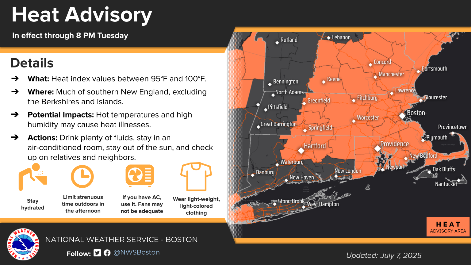
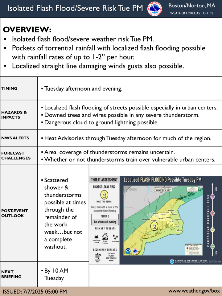
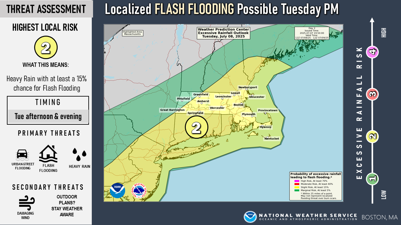
Good afternoon, We are continuing to monitor the potential for an active Tuesday across southern New England, starting as early as the afternoon and lasting through the late evening. The primary hazard is localized flash flooding due to rainfall rates of 1-2" per hour. There is also a secondary threat of a few strong to severe thunderstorms, which could produce damaging straight-line winds. In addition, Tuesday will be hot and humid, with a heat index up to 100°F. Therefore, we have extended the Heat Advisory through 8 PM Tuesday and expanded its coverage to the south coast of Rhode Island and Massachusetts, including Cape Cod. Attached is our one-page briefing and the Heat Advisory map. -Meteorologists: Francis Tarasiewicz, Hayden Frank, and Torry Dooley If you have any questions or would like more information, please don't hesitate to contact us. You can reach us via: email: box.operations@noaa.gov phone: 508.622.3280 Slack/NWSChat 2.0 <https://nwschatws.slack.com/> (for approved partners) social media: Website <http://www.weather.gov/boston> | Facebook <http://www.facebook.com/NWSBoston> | Twitter <http://www.twitter.com/NWSBoston>