
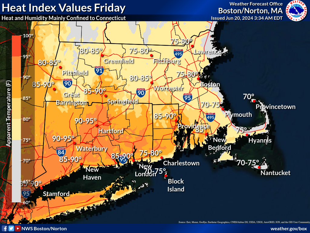
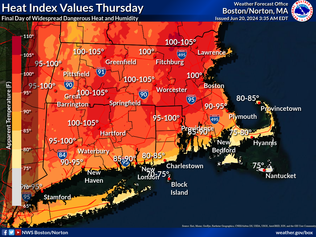
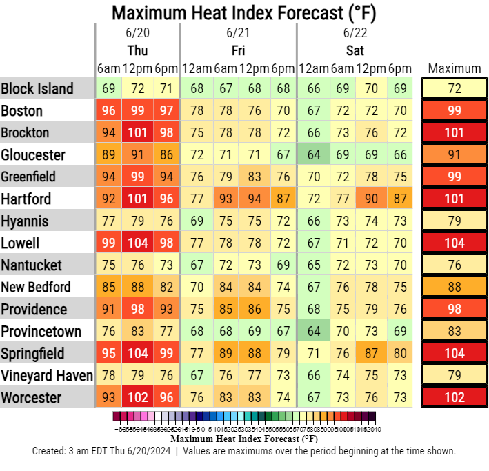
Good morning everyone, Please find our latest briefing attached regarding the continued heat and humidity. In general, the forecast remains unchanged, with today expected to be the final day for oppressive conditions for much of eastern MA and RI as a cold front slides across the region, from northeast to southwest, tomorrow. The heat advisory for these areas will expire tonight at 7 PM. Connecticut will be last to see relief from the front, thus, a Heat Advisory remains in place for portions of the southern CT River Valley and Hartford-Springfield corridor through 7 PM tomorrow. We do anticipate scattered showers and thunderstorms both this afternoon and Friday afternoon. Today, storms will be concentrated north of the MA Turnpike. Tomorrow, storms look to be most widespread across CT. Kind regards, Frank Nocera and Kristie Smith If you have any questions or would like more information, please don't hesitate to contact us. You can reach us via: email: box.operations@noaa.gov phone: 508.622.3280 Slack/NWSChat 2.0 <https://nwschatws.slack.com/> (for approved partners) social media: Website <http://www.weather.gov/boston> | Facebook <http://www.facebook.com/NWSBoston> | Twitter <http://www.twitter.com/NWSBoston>