
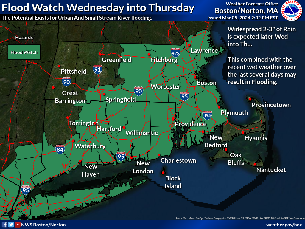
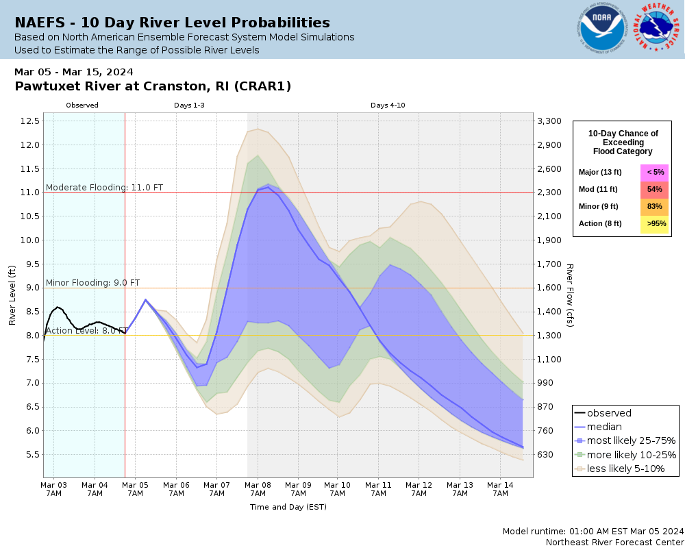
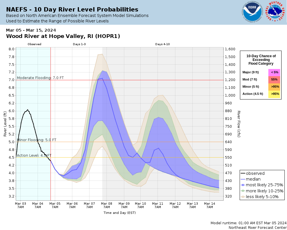
Good afternoon everyone, The threat of heavy rain continues for late Wednesday, Wednesday night and lingering into Thursday morning. A widespread 2-3" of rainfall is likely with a swath of up to 4" possible. These rainfall totals may result in minor to moderate river flooding as well as urban and poor drainage flooding. What has changed from our last briefing: - *The flood watch has been expanded from southeast MA and RI into most of CT (Greater Hartford-Springfield area) and central-eastern MA, including Greater Boston area.* Graphics included - flood watch, ensemble river forecast and hydrographs for the Pawtuxet River at Cranston, RI and the Wood River at Hope Valley, RI. These probabilistic hydrographs show the range of possible outcomes. If the higher rainfall totals materialize, the higher river level probabilities will be realized. Conversely, if less rainfall occurs, the lower river level probabilities will likely verify. If you have any questions, please don't hesitate to reach out. Thank you, Joseph Dellicarpini, Hayden Frank and Frank Nocera If you have any questions or would like more information, please don't hesitate to contact us. You can reach us via: email: box.operations@noaa.gov phone: 508.622.3280 Slack/NWSChat 2.0 <https://nwschatws.slack.com/> (for approved partners) social media: Website <http://www.weather.gov/boston> | Facebook <http://www.facebook.com/NWSBoston> | Twitter <http://www.twitter.com/NWSBoston>