
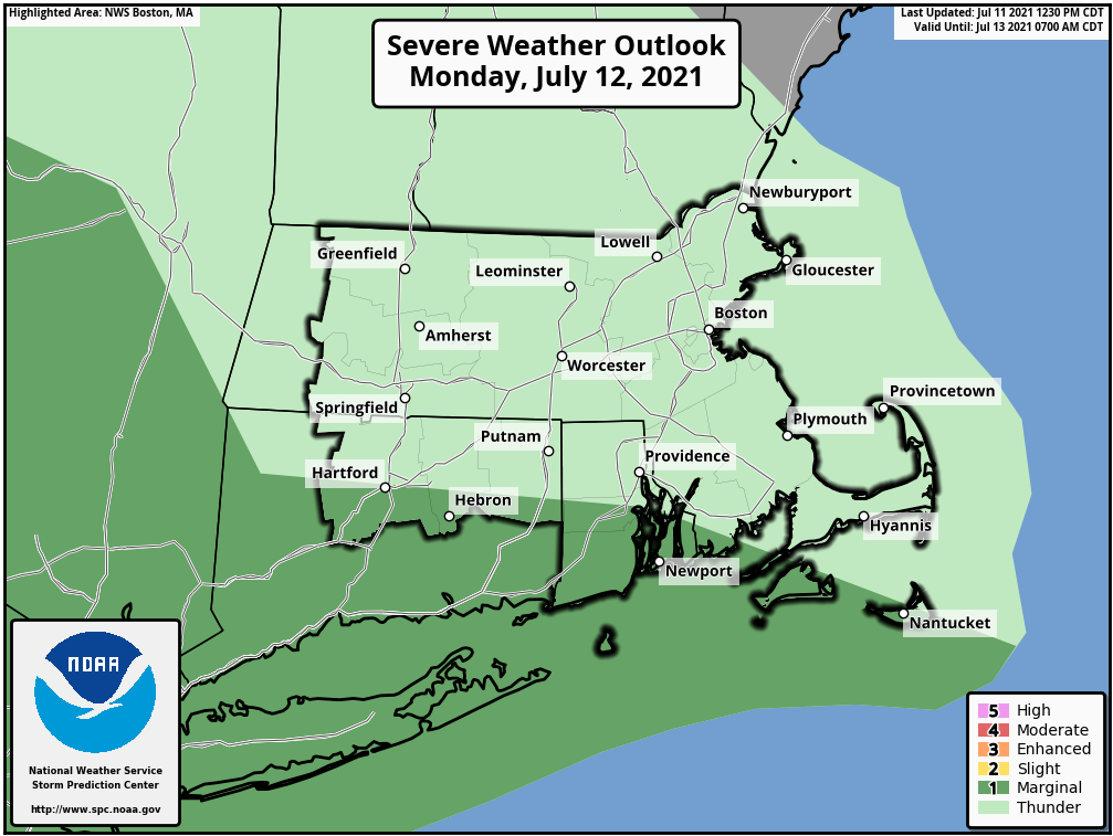
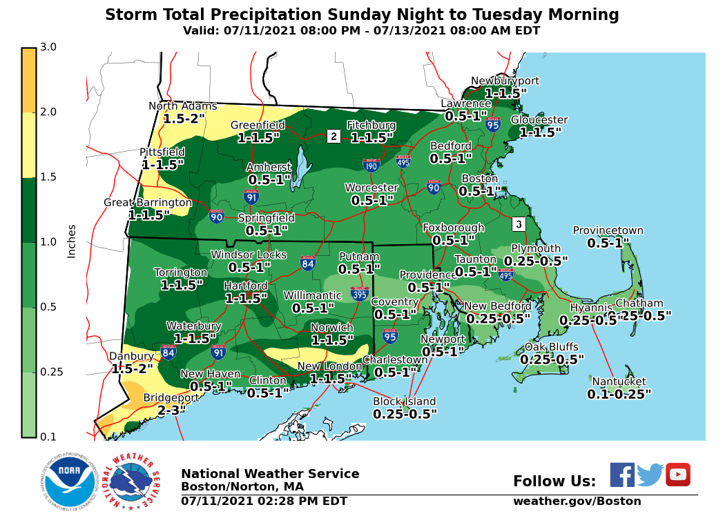
Good afternoon, Please find our latest briefing attached regarding the potential for heavy rain and thunderstorms tomorrow morning and afternoon. Flash Flood Watches have been hoisted for portions of Massachusetts beginning at 8 PM this evening and portions of RI and CT beginning at Noon tomorrow. The primary concern for tomorrow continues to be the potential for 1-2" of rain across already saturated areas. Isolated severe thunderstorms are possible across southern CT, southern RI, and the Islands tomorrow afternoon; SPC has included us in the "enhanced" risk category. Thank you, Meteorologists Kristie Smith, Rob Megnia, and Rodney Chai If you have any questions or would like more information, don't hesitate to contact us via this email address, on NWSChat <https://nwschat.weather.gov/>, or at the following: National Weather Service Boston/Norton, MA 46 Commerce Way Norton, MA 02766 508.622.3280 Website <http://www.weather.gov/boston> | Facebook <http://www.facebook.com/NWSBoston> | Twitter <http://www.twitter.com/NWSBoston> [image: StormTotalQPF_SFC.png] [image: image.png]