
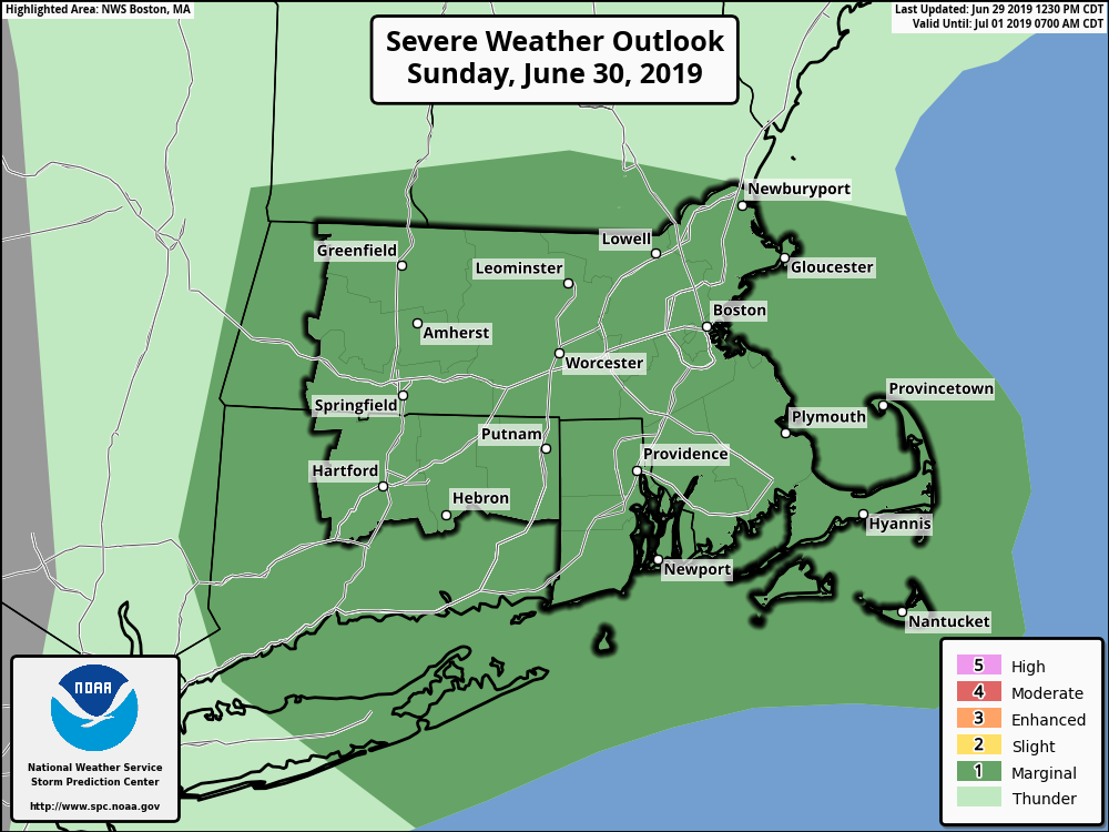
Good evening everyone The threat for additional strong thunderstorms will be winding down this evening. However, another round of strong to severe thunderstorms is expected on Sunday and we have included a brief outline and graphic to this email. *WHAT/WHEN:* - Scattered strong to perhaps severe thunderstorms expected from mid to late Sunday morning into Sunday afternoon. *WHERE:* *- *All of southern New England is at risk, especially central and eastern MA as well as Rhode Island. *POTENTIAL IMPACTS:* - Hail is the main threat with Sunday's thunderstorms. Some hail may become large and reach or exceed the size of a quarter. - Any thunderstorm will be capable of producing 1+ inches of rain in a short period of time. This will bring the potential for localized street flooding. - Locally strong to perhaps damaging wind gusts are a secondary concern. - Dangerous cloud to ground lightning will pose a risk to those with outdoor activities, including mariners and beachgoers. Please let us know if you have any questions or concerns. Thank You Meteorologist: Hayden Frank If you have any questions or would like more information, don't hesitate to contact us via this email address, on NWSChat <https://nwschat.weather.gov/>, or at the following: National Weather Service Boston/Norton, MA 46 Commerce Way Norton, MA 02766 508.622.3280 Website <http://www.weather.gov/boston> | Facebook <http://www.facebook.com/NWSBoston> | Twitter <http://www.twitter.com/NWSBoston>