
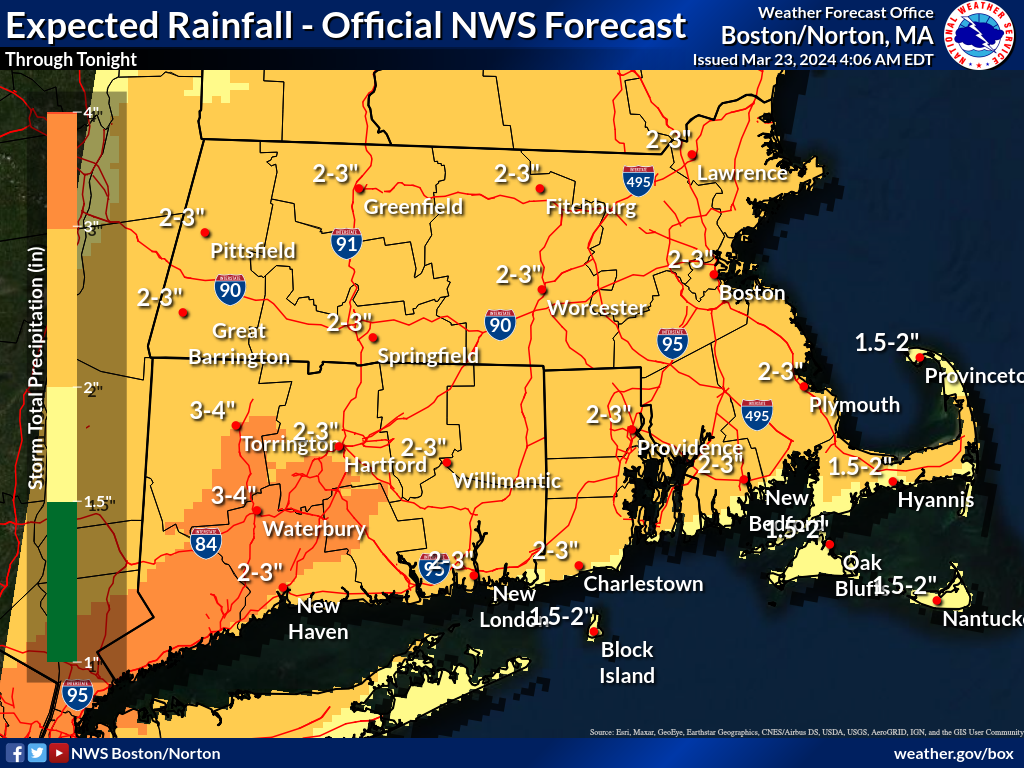
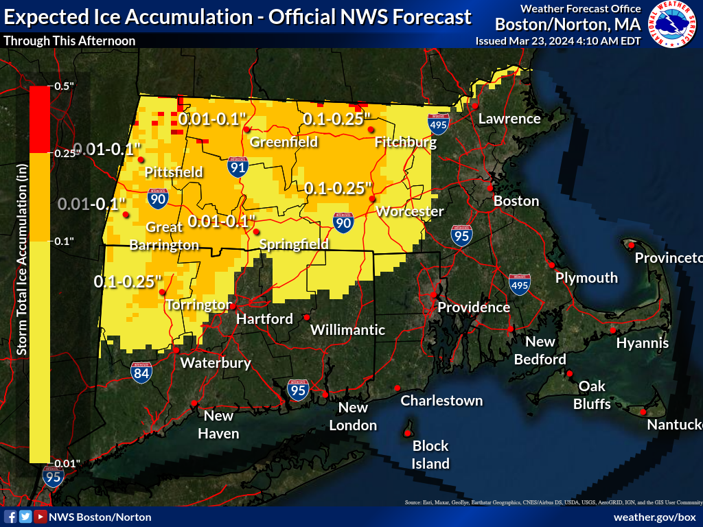
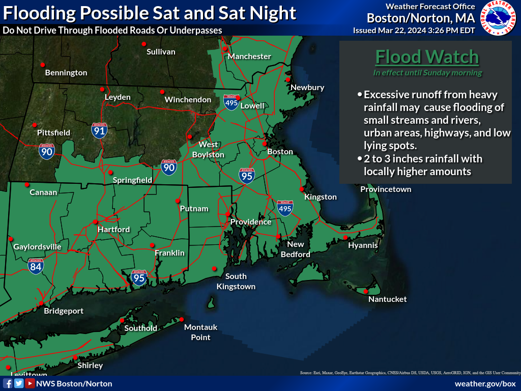
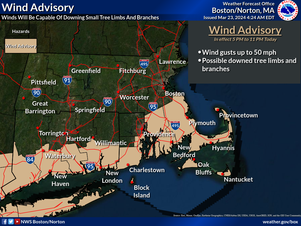
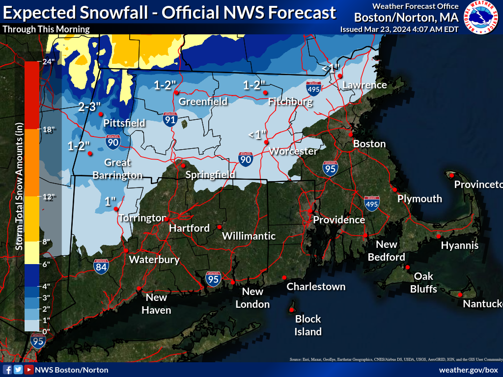
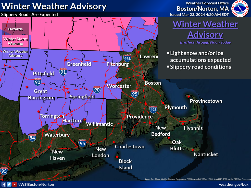
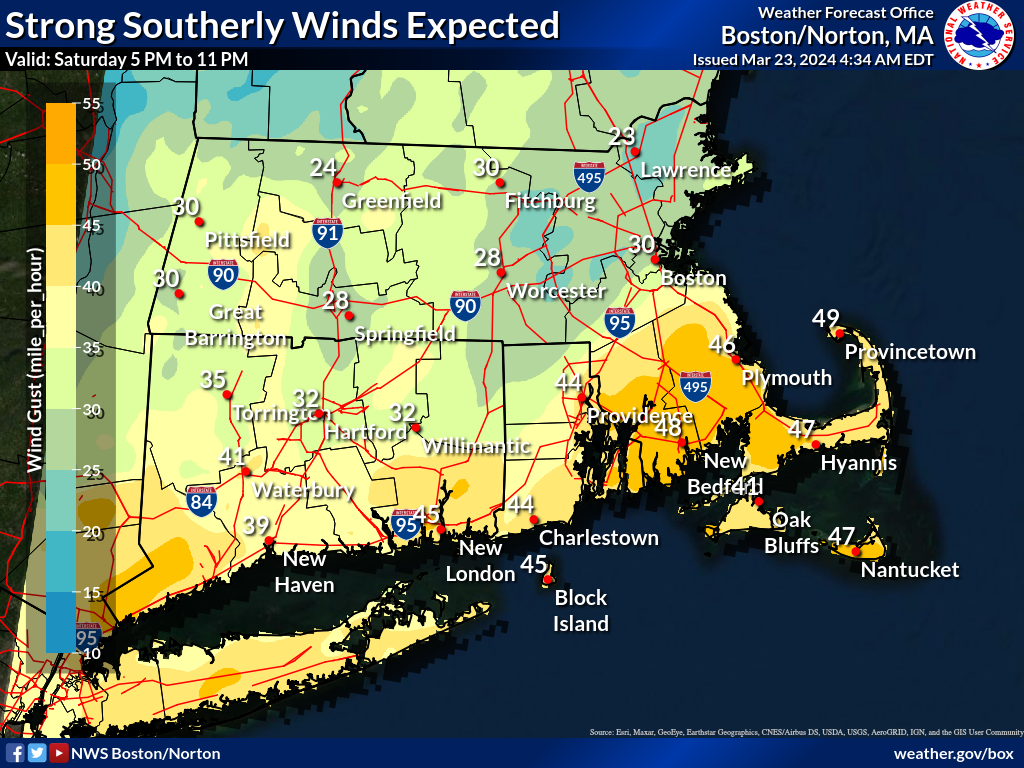
Good morning, Here is our latest one pager briefing for the storm which will be impacting the region through this evening. The following changes have been made since the last briefing. - Winter Weather Advisory expanded across all of northern CT and into southern Worcester county for light ice accumulation this morning - Ice accumulation increased to one tenth to one quarter inch across the Berkshires and Worcester Hills - Wind Advisory issued for the southern CT/RI, SE MA and Cape/Islands for a period of south wind gusts to 50 mph late today and this evening - Coastal Flood Statement issued for the risk of very minor flooding along the upper reaches of Narragansett Bay for the evening high tide. There were no changes to expected rainfall with widespread 2 to 3 inches and locally higher amounts. The heaviest rain will fall between 4 pm and midnight. It appears the axis of heaviest rainfall will set up across CT, RI and possibly into portions of southeast MA. Concerns continue for river flooding, especially the Wood, Pawcatuck and Pawtuxet Rivers in RI. We will also need to monitor the Taunton River in southeast MA closely. Thanks. Kevin Cadima and Torry Dooley If you have any questions or would like more information, please don't hesitate to contact us. You can reach us via: email: box.operations@noaa.gov phone: 508.622.3280 Slack/NWSChat 2.0 <https://nwschatws.slack.com/> (for approved partners) social media: Website <http://www.weather.gov/boston> | Facebook <http://www.facebook.com/NWSBoston> | Twitter <http://www.twitter.com/NWSBoston>