
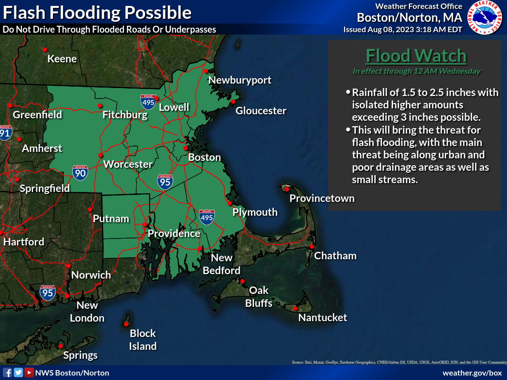
Good morning, There is growing confidence that localized areas in eastern Massachusetts and Rhode Island may experience flooding due to torrential rainfall this morning and early afternoon, with rainfall between 1.5 to 2.5 inches, with isolated higher amounts exceeding 3 inches possible. As a result, we have issued a Flood Watch for eastern Massachusetts (excluding Cape Cod and the Islands) and all of Rhode Island (excluding Washington County). The Flood Watch is in effect until 12 AM Wednesday, see the attached image below. Additionally, this morning, there is still a low threat for isolated strong to severe thunderstorms that could produce damaging wind gusts, along with a brief tornado or waterspout. Thank you, Rob Megnia and Torry Dooley If you have any questions or would like more information, please don't hesitate to contact us. You can reach us via: email: box.operations@noaa.gov phone: 508.622.3280 Slack/NWSChat 2.0 <https://nwschatws.slack.com/> (for approved partners) social media: Website <http://www.weather.gov/boston> | Facebook <http://www.facebook.com/NWSBoston> | Twitter <http://www.twitter.com/NWSBoston>