
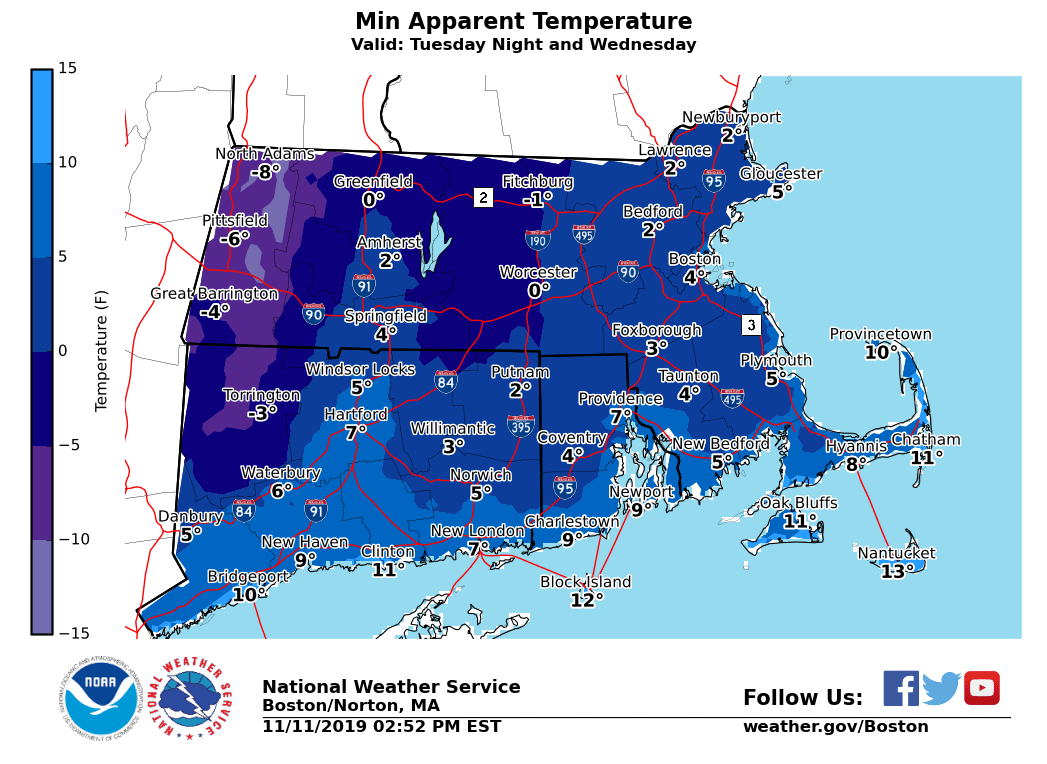
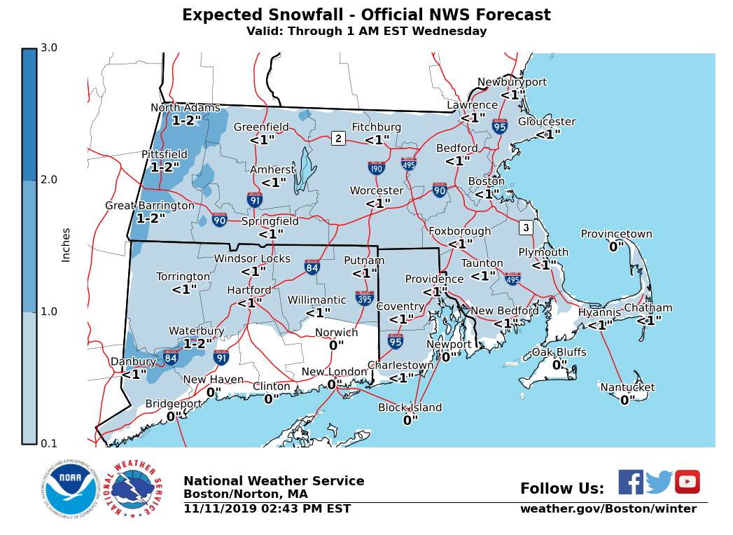
Good afternoon, Expectations for wintry weather have changed slightly Tuesday into Tuesday evening. The colder air is now thought to arrive more quickly, meaning a lesser risk for freezing rain. Our current forecast has rain briefly mixing with snow, before changing to snow, from west to east. The timing for this changeover to snow should be towards mid morning along and west of the Connecticut River in MA, to around noon in central MA and northeast CT, to mid afternoon along the I-95 corridor in MA and RI. Snowfall is expected to end along and west of the I-95 corridor in MA and RI by 6-7 PM. This means some light snow may impact the Tuesday afternoon commute across eastern MA and RI. Snow amounts are still expected to be light, generally a coating to an inch of snow is likely. Please see the attached snowfall map for more details. The other concern early this week will be the cold Tuesday night through Wednesday night. Slightly higher temperatures through the rest of this work week, but still below normal. Minimum wind chill values mainly 0-10 above zero across southern New England, ranging to 0 to 10 below zero across the higher terrain of the Berkshires and northwest CT. Matthew Belk If you have any questions or would like more information, don't hesitate to contact us via this email address, on NWSChat <https://nwschat.weather.gov/>, or at the following: National Weather Service Boston/Norton, MA 46 Commerce Way Norton, MA 02766 508.622.3280 Website <http://www.weather.gov/boston> | Facebook <http://www.facebook.com/NWSBoston> | Twitter <http://www.twitter.com/NWSBoston>