
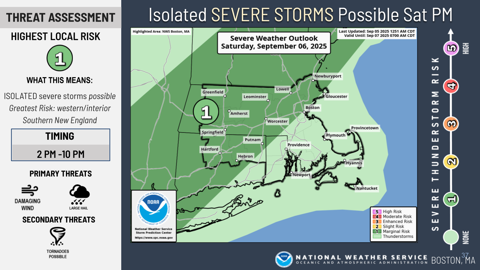
Good morning, This is a follow-up to yesterday’s email regarding the potential for severe weather on Saturday. At this time, there are no significant changes to the forecast. The greatest risk remains across western and central Massachusetts and western Connecticut Saturday afternoon and evening. Storms are still expected to weaken as they move into Rhode Island and eastern Massachusetts after sunset. Primary hazards continue to include damaging winds, large hail, and a low probability of a tornado. Please see the attached one-page briefing for additional details. We will provide another update this afternoon. Please reach out with any questions in the meantime. Thank you, Torry Dooley If you have any questions or would like more information, please don't hesitate to contact us. You can reach us via: email: box.operations@noaa.gov phone: 508.622.3280 Slack/NWSChat 2.0 <https://nwschatws.slack.com/> (for approved partners) social media: Website <http://www.weather.gov/boston> | Facebook <http://www.facebook.com/NWSBoston> | Twitter <http://www.twitter.com/NWSBoston>