
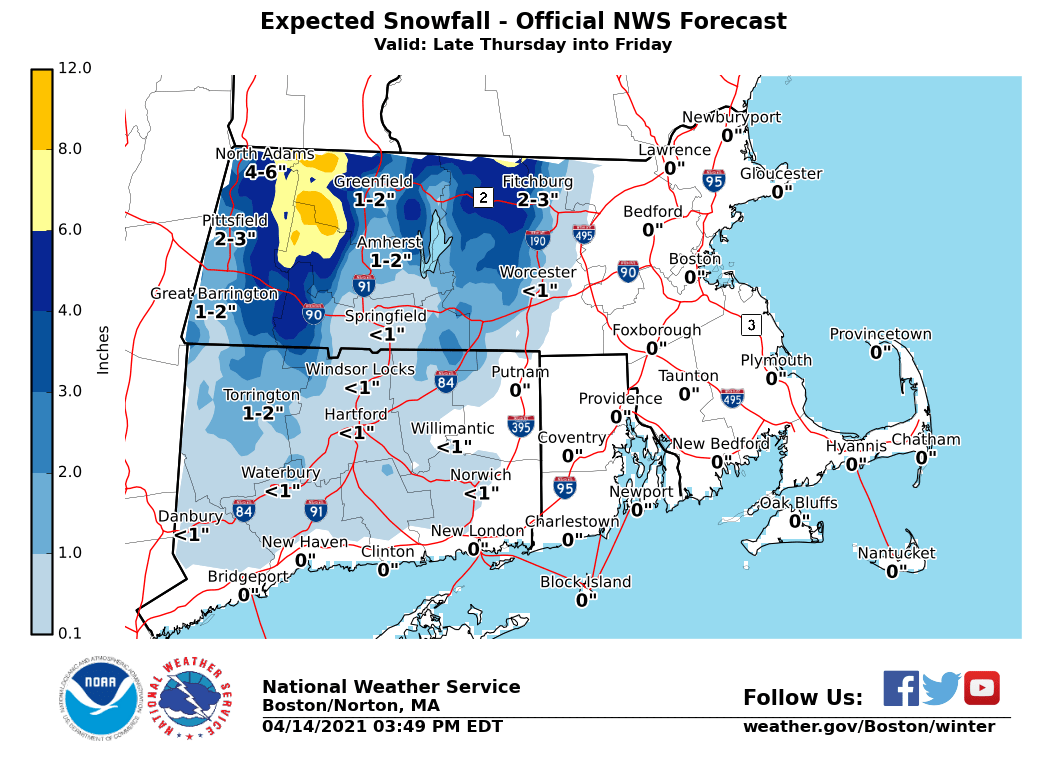
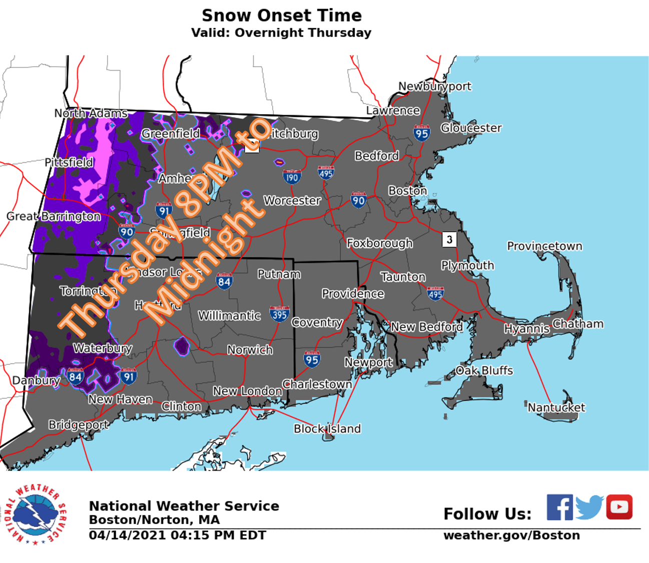
Good afternoon everyone, Accumulating snow remains on track across the higher elevations (mainly above 1500 ft) late Thursday night into Friday. A Winter Storm Watch remains in effect for the Berkshires for 4 to 8 inches of snow, with locally higher amounts possible. The snow is expected to be wet and heavy with Snow to Liquid Ratios (SLRs) around 8:1. Please find attached a one-pager with more details as well as the expected snowfall and onset time graphic. If you have any questions, we can be reached via box.operations@noaa.gov or 508-622-3280. Thanks, Rodney Chai and Kevin Cadima If you have any questions or would like more information, don't hesitate to contact us via this email address, on NWSChat <https://nwschat.weather.gov/>, or at the following: National Weather Service Boston/Norton, MA 46 Commerce Way Norton, MA 02766 508.622.3280 Website <http://www.weather.gov/boston> | Facebook <http://www.facebook.com/NWSBoston> | Twitter <http://www.twitter.com/NWSBoston>