
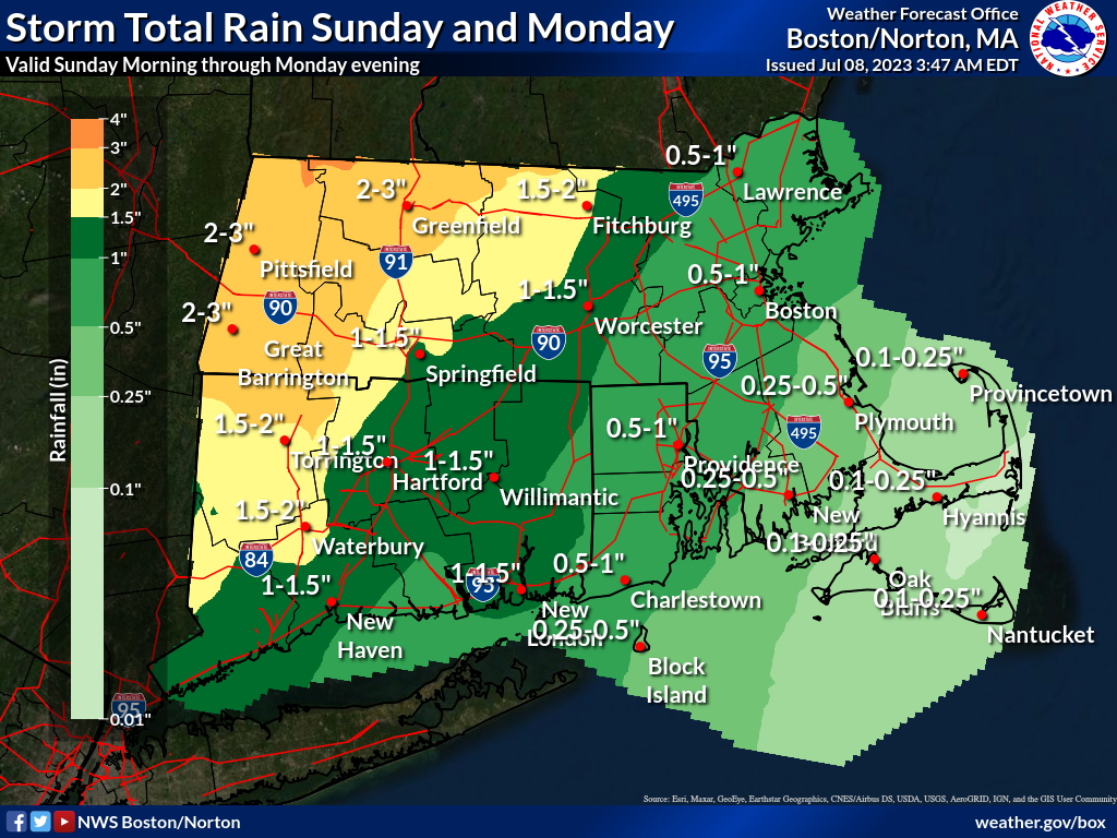
Good morning, Attached is the latest one page briefing regarding the heavy rainfall threat Sunday night into Monday. Very little has changed since our update yesterday afternoon. The axis of heaviest rainfall has shifted slightly north and west. The greatest risk for excessive rainfall remains focused over western MA and CT. We should have more details with this afternoon's update as we'll be entering the window of hi resolution model guidance. Thank you and have a great start to the weekend, Rob Megnia and Kevin Cadima If you have any questions or would like more information, don't hesitate to contact us via this email address, on NWSChat <https://nwschat.weather.gov/>, or at the following: National Weather Service Boston/Norton, MA 46 Commerce Way Norton, MA 02766 508.622.3280 Website <http://www.weather.gov/boston> | Facebook <http://www.facebook.com/NWSBoston> | Twitter <http://www.twitter.com/NWSBoston>