
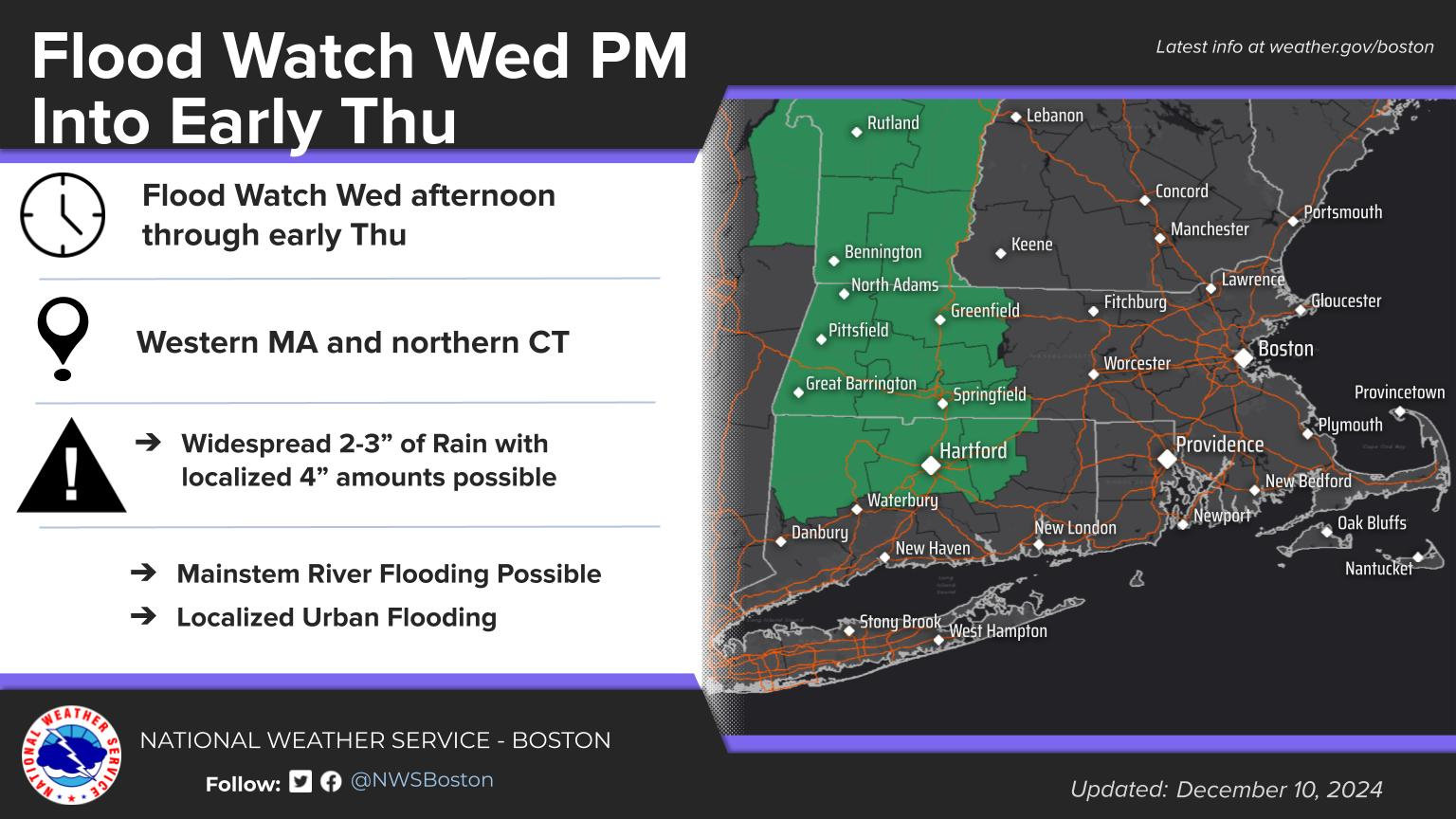
Good morning everyone... We did want to mention that areas of freezing drizzle/black ice will be possible in north central and northeast MA this morning with temps near or just below 32 degrees. Otherwise...listed below are the updates to the Wednesday and Wednesday night portion of the forecast in regards to heavy rain/flooding potential and strong wind gusts. We have also included the updated one-pager as well as some graphical images. 1) High Wind Watch Expanded to cover all eastern MA & RI Wed into Wed night for the potential of southerly wind gusts of 50-60 mph. 2) Flood Watch Issued for western MA and parts of northern CT. Widespread 2-3" or rain with localized 4" amounts possible. Some Mainstem River Flooding and localized urban flooding possible. Thank You Meteorologist: Hayden Frank If you have any questions or would like more information, please don't hesitate to contact us. You can reach us via: email: box.operations@noaa.gov phone: 508.622.3280 Slack/NWSChat 2.0 <https://nwschatws.slack.com/> (for approved partners) social media: Website <http://www.weather.gov/boston> | Facebook <http://www.facebook.com/NWSBoston> | Twitter <http://www.twitter.com/NWSBoston>