
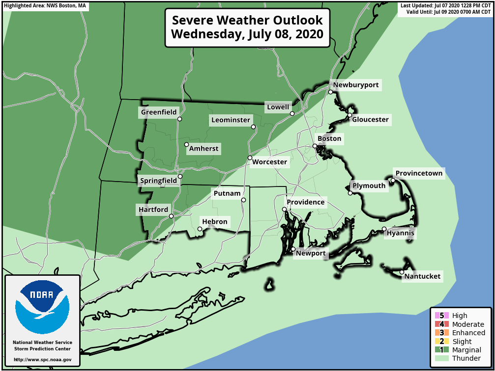
Good afternoon, all: There are a couple of weather items we wanted to notify you about going into the latter half of this week. 1. There is a Marginal risk for severe thunderstorms tomorrow afternoon and evening. The greatest risk will be across interior southern New England, mainly due to potential for damaging wind, with a slightly lesser risk for damaging hail. Another concern will be the potential for flooding rainfall, as the air will definitely have a tropical feel to it. 2. Also of concern is the potential for significant rainfall sometime Friday into Saturday. This would be in connection to a possible coastal low pressure, which will have a feed of tropical moisture. There is a 40% chance this system could develop into a tropical cyclone over the next 5 days somewhere near the Mid Atlantic states. The current forecast timing, which is subject to change, is for showers and thunderstorms to develop during the day Friday, continue through Saturday, before gradually diminishing Saturday night into Sunday. Matt Belk If you have any questions or would like more information, don't hesitate to contact us via this email address, on NWSChat <https://nwschat.weather.gov/>, or at the following: National Weather Service Boston/Norton, MA 46 Commerce Way Norton, MA 02766 508.622.3280 Website <http://www.weather.gov/boston> | Facebook <http://www.facebook.com/NWSBoston> | Twitter <http://www.twitter.com/NWSBoston>