
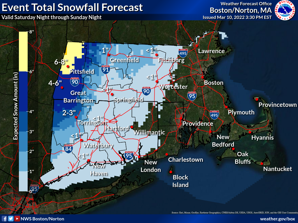
Good afternoon everyone, We're monitoring the potential for an active first half of the upcoming weekend as strengthening low-pressure system traverses across southern New England. Below are our key messages. - Widespread moderate to heavy rainfall could lead to minor poor drainage and urban flooding on Saturday. - Rain is likely to transition to snow across far northwestern Massachusetts and Connecticut late Saturday morning through early Saturday afternoon. Icy and slick roadways are possible in areas that see accumulating snow and sub-freezing temperatures. - The strongest wind gusts Saturday night through late Sunday morning as northwest winds gust 30 to 40 mph. Strong gusts could produce minor tree and powerline damage. Headlines: Winter Storm Watch in effect for northern Berkshire County in Massachusetts from 1 AM March 12th to 1 AM March 13th. Next briefing: 6 AM Friday. Meteorologists Bryce Williams, Torry Gaucher, and Andrew Loconto If you have any questions or would like more information, don't hesitate to contact us via this email address, on NWSChat <https://nwschat.weather.gov/>, or at the following: National Weather Service Boston/Norton, MA 46 Commerce Way Norton, MA 02766 508.622.3280 Website <http://www.weather.gov/boston> | Facebook <http://www.facebook.com/NWSBoston> | Twitter <http://www.twitter.com/NWSBoston>