[2020.01.15 PM] NWS Boston EM Briefing

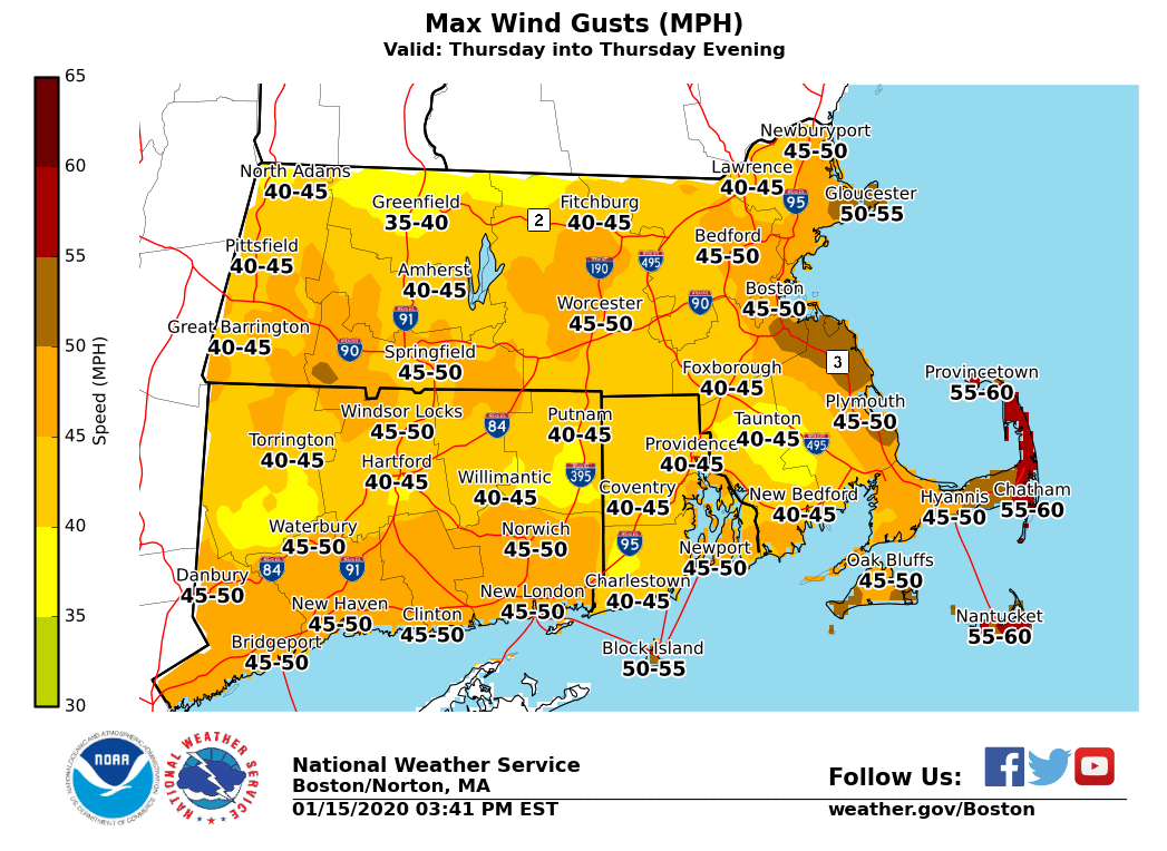
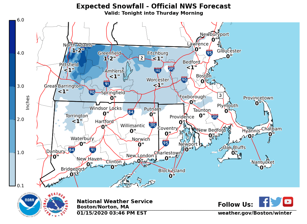
Good afternoon everyone, We have a few weather concerns for the next few days which will be highlighted below. *Minor snow accumulations late tonight:* *What/Where:* 1-2 inches interior northern MA with up to 3 inches in the northern Berkshires *Timing:* A period of snow developing after midnight and ending Thursday morning. *Impacts:* Untreated roads may be slippery during the morning commute. *Strong winds Thursday:* *What:* Northwest gusts 40 to 55 mph. A Wind Advisory is in effect. *Where:* All of southern New England *When:* Thursday into Thursday evening *Impacts:* Some tree damage with isolated power outages. *Potential for accumulating snow Saturday afternoon/night:* *What/Where/When:* - Plowable snow accumulations possible away from immediate south coast - Several inches possible across interior northern and NW MA where max snowfall expected - Snow developing Saturday afternoon from west to east, likely changing to rain along the coast in the evening with rain-snow line advancing north across the region during the night. - Precipitation ending late Saturday night *Uncertainty:* - Timing of changeover and how far north rain-snow line gets is uncertain and this will impact specific snowfall accumulations - Moderate to high confidence in a period of accumulating snow but specific amounts uncertain Please let us know if you have any questions or concerns! Thank You Meteorologist: Kevin Cadima If you have any questions or would like more information, don't hesitate to contact us via this email address, on NWSChat <https://nwschat.weather.gov/>, or at the following: National Weather Service Boston/Norton, MA 46 Commerce Way Norton, MA 02766 508.622.3280 Website <http://www.weather.gov/boston> | Facebook <http://www.facebook.com/NWSBoston> | Twitter <http://www.twitter.com/NWSBoston>
participants (1)
-
 BOX Operations - NOAA Service Account