[2020.01.16 430 AM] NWS Boston EM Briefing

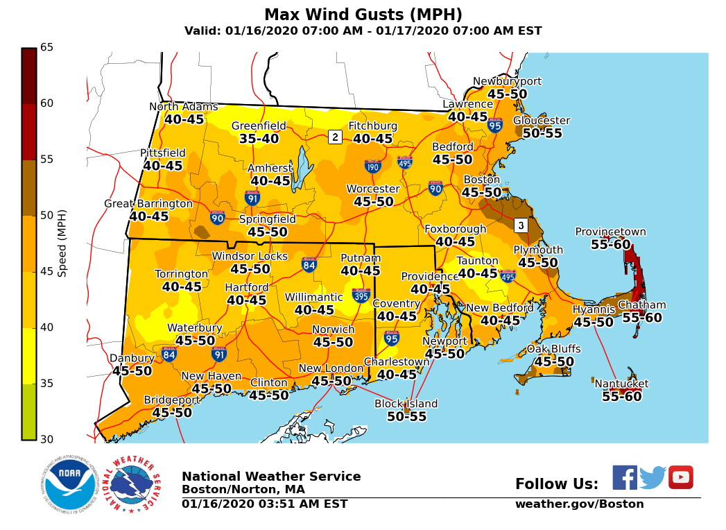
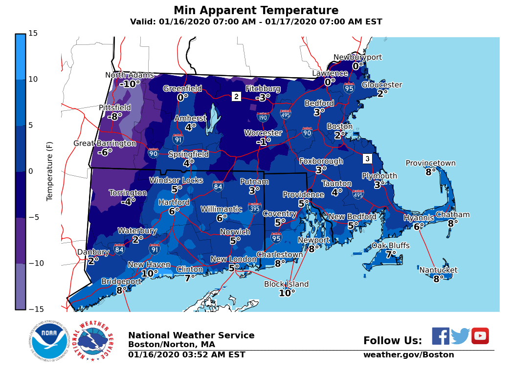
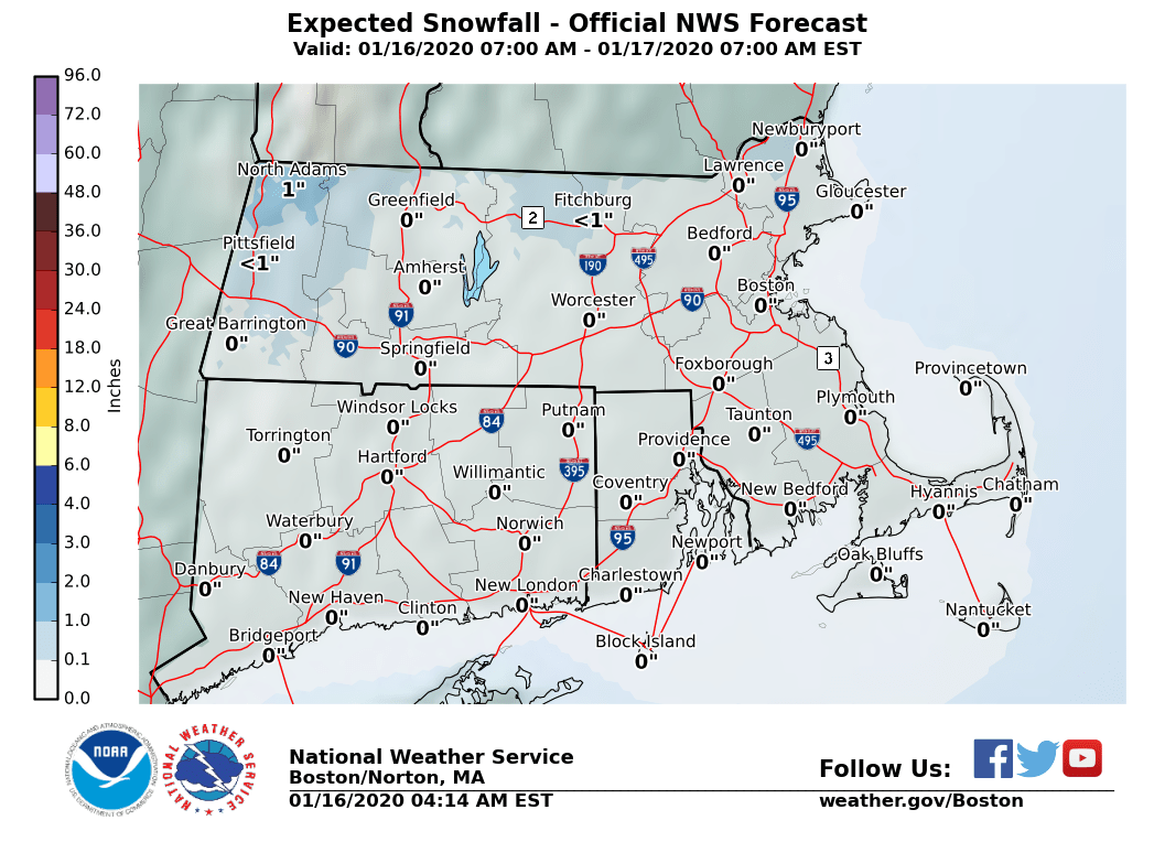
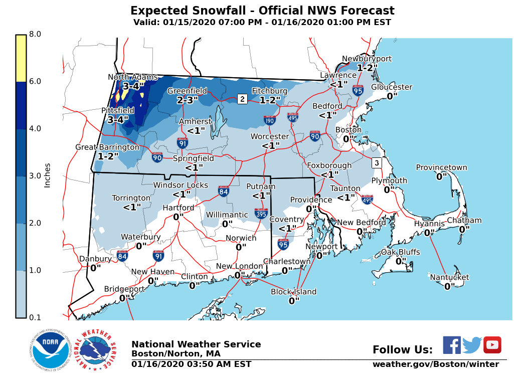
Good morning everyone, We are still looking at some weather concerns the next few days. See below and the attached images for more details. *No new changes* to the strong winds expected today and the snow potential this weekend. **Please note** the Storm Total and Additional Snowfall Amount Maps have been included for the storm moving through this morning. The Additional Snowfall Amount map are the amounts expected to accumulate from now until the storm ends. The Storm Total Amount map are the amounts expected combining what has already fallen and additional amounts anticipated. *Rain/Snow Ending this Morning:* *What/Where:* *Additional amounts of up to 1 inch* across interior northern MA, which will bring the storm total amounts to 2-4 inches across interior northern MA. Little to no accumulation expected elsewhere. *Timing:* Precipitation tapering off this morning. *Impacts:* Untreated roads could be slick for the morning commute. *Strong winds Today:* *What/Where:* Northwest gusts 40 to 55 mph. A Wind Advisory is in effect for all of southern New England. *When:* Strongest gusts this afternoon and tonight. *Impacts:* Some tree damage with isolated power outages. *Cold Wind Chills Tonight into Friday Morning:* *What/Where:* Wind chills near zero across all of southern New England. A few spots across northwest Connecticut, central and western Massachusetts could see wind chills fall to 5 to 15 below zero. *Impacts:* Prolonged exposure could lead to cold related health impacts. *Potential for accumulating snow Saturday afternoon/night:* *What/Where/When:* - Plowable snow accumulations possible away from immediate south coast. - Several inches possible across interior northern and NW MA where the highest totals are expected. - Snow develops Saturday afternoon from west to east, likely changing to a wintry mix and eventually rain along the coast in the evening. Expect this mix/rain-snow line to advance north across the region during the night. - Precipitation ending late Saturday night and early Sunday morning. *Uncertainty:* - Timing the changeover and how far north the mix/rain-snow line gets is uncertain and will impact specific totals. - Moderate to high confidence in a period of accumulating snow but specific amounts uncertain. Please let us know if you have any questions or concerns! Thank You Meteorologists: Andrew Loconto and Bill Leatham If you have any questions or would like more information, don't hesitate to contact us via this email address, on NWSChat <https://nwschat.weather.gov/>, or at the following: National Weather Service Boston/Norton, MA 46 Commerce Way Norton, MA 02766 508.622.3280 Website <http://www.weather.gov/boston> | Facebook <http://www.facebook.com/NWSBoston> | Twitter <http://www.twitter.com/NWSBoston>
participants (1)
-
 BOX Operations - NOAA Service Account