[2023.03.01 PM] NWS Boston EM Briefing: Potential for Impactful Winter Weather Friday afternoon and Saturday

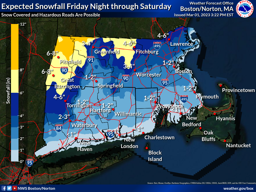
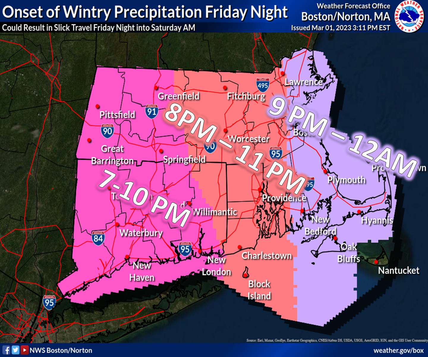
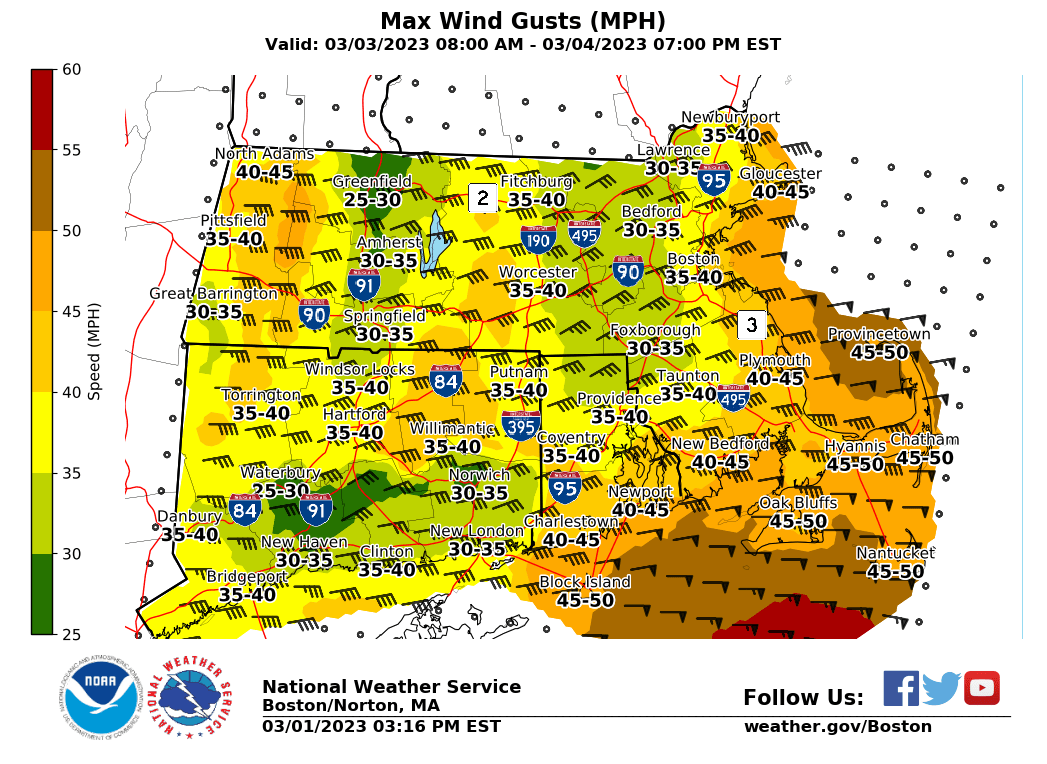
Good afternoon, Please find our latest update regarding the accumulating snow potential late Friday night-Saturday morning attached below. We would like to emphasize that precipitation is not expected to begin until AFTER the Friday Evening commute. Additionally, confidence in accumulating snow is highest north of the I-90 corridor, with the greatest risk for accumulations in excess of 6" most likely above 600ft in elevation north of the Rte 2 Corridor. Travel impacts are expected to be limited south of the MA Turnpike, as temperatures will remain near or above freezing overnight. Minor shifts in the exact track of the system will result in changes to the potential for accumulating snowfall. We also anticipate that winds in excess of 40 mph will affect the eastern MA coastline, with winds gusting over 50 mph possible, especially across the Cape and Islands. A gale watch is currently in place for the waters. Mariners should be aware that storm warnings may need to be considered for a large portion of Saturday. While we do not currently have winter weather headlines in place for this system, it is likely that they will be considered over the next 24 hours. Please do not hesitate to reach out with any questions. Kristie Smith, Bill Leatham, and Hayden Frank If you have any questions or would like more information, don't hesitate to contact us via this email address, on NWSChat <https://nwschat.weather.gov/>, or at the following: National Weather Service Boston/Norton, MA 46 Commerce Way Norton, MA 02766 508.622.3280 Website <http://www.weather.gov/boston> | Facebook <http://www.facebook.com/NWSBoston> | Twitter <http://www.twitter.com/NWSBoston>
participants (1)
-
 BOX Operations - NOAA Service Account