[2023.03.01 AM] NWS Boston EM Briefing: Potential for Impactful Winter Weather Friday afternoon and Saturday

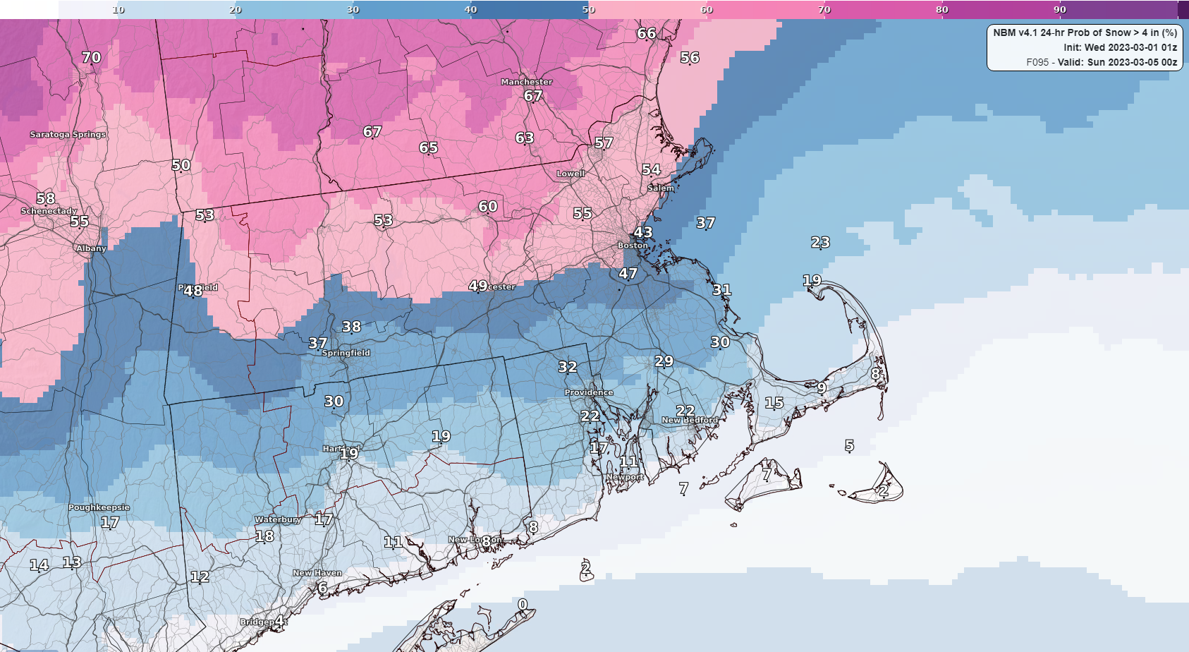
Good morning, We wanted to begin messaging for a potentially impactful winter storm that will impact the Northeast Friday afternoon into Saturday. Attached is a one page briefing with some details on where the forecast stands at this point in time. Confidence is growing that there will be at least minor impacts for the areas north of I-90. The attached graphic represents the percent chance of 24 hour snowfall exceeding 4 inches. We'll have more details over the next 24 hours as new data becomes available. Additionally, since we are sending this email we wanted to provide a heads up that there is also a chance for some spotty freezing rain showers tonight over the high terrain of The Worcester Hills and The Berkshires. Given the expected isolated/spotty nature of these showers, there is no winter weather advisory in effect for freezing rain. There will however be the potential for a few slick spots over these areas, but little to no impacts are expected. Thank you and have a great day, Robert Megnia and Matthew Belk If you have any questions or would like more information, don't hesitate to contact us via this email address, on NWSChat <https://nwschat.weather.gov/>, or at the following: National Weather Service Boston/Norton, MA 46 Commerce Way Norton, MA 02766 508.622.3280 Website <http://www.weather.gov/boston> | Facebook <http://www.facebook.com/NWSBoston> | Twitter <http://www.twitter.com/NWSBoston>
participants (1)
-
 BOX Operations - NOAA Service Account