NWS Boston EM Briefing: Impacts From Tropical Storm Fay

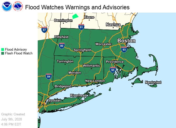
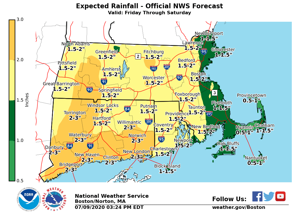
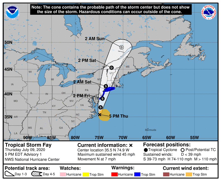
Good Afternoon Everyone, The following changes have been made to the forecast: *- Tropical Storm Warning issued for the Connecticut coast.* *- Flash Flood Watches issued for all of Connecticut, Massachusetts, and Rhode Island from Friday afternoon into Saturday morning.* Tropical Storm Fay has formed off the coast of North Carolina. It is forecast to track north and pass over western Long Island and western Connecticut Saturday morning. *The main concern from Fay in southern New England is the potential for flash flooding from heavy rainfall Friday night into Saturday. * Here are the key points regarding the main threats from Fay: *Flash Flooding:* We are most confident in the potential for heavy rainfall Friday night into Saturday morning. Rainfall of 1 to 2 inches is likely with locally higher amounts. Minor urban flooding is likely but more significant urban and small stream flooding is possible depending on where the heaviest rain falls. *Wind:* While it is more likely that sustained tropical storm force winds remain along the Connecticut coast, it is still possible that the track of Fay shifts east in later forecast, which could bring tropical storm force winds to the Rhode Island coast and adjacent waters. Prevailing wind direction should be from the south or southeast. *Rip Currents:* There is a moderate to high risk of rip currents Friday through Sunday on south coastal beaches. *Severe Weather:* There is the threat for an isolated severe thunderstorm, and with that a tornado is possible. The next email briefing will be sent early Friday morning. If you have any questions or would like more information, don't hesitate to contact us via this email address, on NWSChat <https://nwschat.weather.gov/>, or by phone at 508.622.3280. Thanks, Joe DelliCarpini
participants (1)
-
 BOX Operations - NOAA Service Account